
Bilde:Limpopo watershed topo.png
Fra Wikipedia, den frie encyklopedi
Størrelse på denne forhåndsvisningen: 800 × 570 punkter
Høyere oppløsning (1 150 × 820 punkter, filstørrelse: 591 KB, MIME-type: image/png)
| | Denne filen er fra Wikimedia Commons, og er en delt fil mellom alle Wikimedia-prosjekter. |
[edit] Summary
| Description |
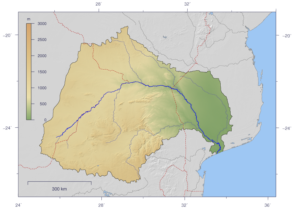
English: Course and Watershed of the Limpopo River with topography shading and political boundaries.
Deutsch: Verlauf und Einzugsgebiet des Limpopo mit Reliefschattierung und Staatsgrenzen.
|
||
|---|---|---|---|
| Source |
The map has been created with the Generic Mapping Tools: http://gmt.soest.hawaii.edu/ using additional public comain data from the VMAP0 data set. |
||
| Date |
2007-02-25 |
||
| Author | |||
| Permission (Reusing this image) |
|
||
| Other versions | Image:Limpopo_watershed_plain.png |
[edit] Licensing
|
Filhistorikk
Klikk på et tidspunkt for å se filen som den så ut på det tidspunktet.
| Dato/klokkeslett | Dimensjoner | Bruker | Kommentar | |
|---|---|---|---|---|
| nåværende | 25. feb 2007 kl. 17:10 | 1 150×820 (591 KB) | Imagico | ({{Information |Description= {{en|Course and Watershed of the Limpopo River with topography shading and political boundaries.}} {{de|Verlauf und Einzugsgebiet des Limpopo mit Reliefschattierung und Staatsgrenzen.}} |Source=The map has been created with the) |
Billedlenker
Følgende sider har lenker til denne filen:

