Immagine:Kansai closeup.jpg
Da Wikipedia, l'enciclopedia libera.
Non sono disponibili versioni a risoluzione più elevata.
Kansai_closeup.jpg (800 × 600 pixel, dimensioni: 66 KB, tipo MIME: image/jpeg)
Questo file e la sua pagina di descrizione si trovano su Wikimedia Commons.
Se non hai mai usato Commons, visita la pagina di benvenuto o leggi le FAQ.
[edit] Summary
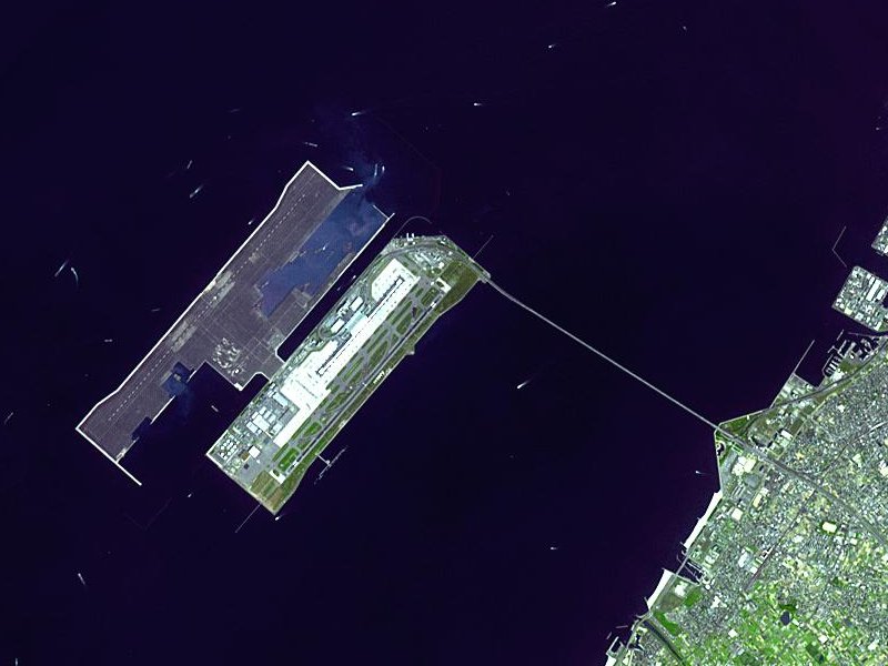
Satellite image of Kansai International Airport in Osaka Bay in Japan. This is a closeup - for an overview image showing the airport on its artificial island in the bay, see Image:Wfm kansai overview.jpg
Taken from an uncopyrighted image NASA Earth Observatory at [1]
"The purpose of NASA's Earth Observatory is to provide a freely-accessible publication on the Internet where the public can obtain new satellite imagery and scientific information about our home planet. The focus is on Earth's climate and environmental change. In particular, we hope our site is useful to public media and educators. Any and all materials published on the Earth Observatory are freely available for re-publication or re-use, except where copyright is indicated. We ask that NASA's Earth Observatory be given credit for its original materials."
[edit] Licensing
|
|
This file is in the public domain because it was created by NASA. NASA copyright policy states that "NASA material is not protected by copyright unless noted". (NASA copyright policy page or JPL Image Use Policy).
Deutsch | English | Español | Français | Nederlands | Português | Русский | 中文(简体) | 中文(繁體) | +/- |
|
 |
Warnings:
|
Cronologia di questa immagine
Fare clic su un gruppo data/ora per vedere il file come si presentava nel momento indicato.
| Data | Dimensioni | Utente | Commento | |
|---|---|---|---|---|
| corrente | 05:46, 13 dic 2005 | 800×600 (66 KB) | Sam916 | (Satellite image of Kansai International Airport in Osaka Bay in Japan. This is a closeup - for an overview image showing the airport on its artificial island in the bay, see Image:Wfm kansai overview.jpg Taken from an uncopyrighted imag) |
Pagine che usano questa immagine
Le pagine seguenti richiamano questa immagine:

