Immagine:Zambiamap.png
Da Wikipedia, l'enciclopedia libera.
Dimensioni di questa anteprima: 655 × 599 pixel
Versione ad alta risoluzione (952 × 871 pixel, dimensioni: 54 KB, tipo MIME: image/png)
Questo file e la sua pagina di descrizione si trovano su Wikimedia Commons.
Se non hai mai usato Commons, visita la pagina di benvenuto o leggi le FAQ.
 |
This map has been uploaded by Electionworld from en.wikipedia.org to enable the |
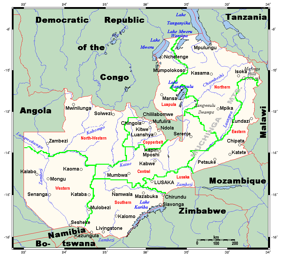
Map of Zambia, major towns, waterways, physical features, etc. This map's source is here, with the uploader's modifications, and the GMT homepage says that the tools are released under the GNU General Public License.
[edit] Licensing

Cronologia di questa immagine
Fare clic su un gruppo data/ora per vedere il file come si presentava nel momento indicato.
| Data | Dimensioni | Utente | Commento | |
|---|---|---|---|---|
| corrente | 00:14, 12 dic 2006 | 952×871 (54 KB) | Electionworld | ({{ew|en|Kelisi}} Map of Zambia, major towns, waterways, physical features, etc. This map's source is [http://www.aquarius.geomar.de/omc/make_map.html here], with the uploader's modifications, and the [http://gmt.soest.hawaii.edu/ GMT homepage] says that t) |
Pagine che usano questa immagine
Le pagine seguenti richiamano questa immagine:

