Immagine:Ph locator map batangas.png
Da Wikipedia, l'enciclopedia libera.
Non sono disponibili versioni a risoluzione più elevata.
Ph_locator_map_batangas.png (300 × 440 pixel, dimensioni: 19 KB, tipo MIME: image/png)
Questo file e la sua pagina di descrizione si trovano su Wikimedia Commons.
Se non hai mai usato Commons, visita la pagina di benvenuto o leggi le FAQ.
Source: en:Image:Ph locator map batangas.png
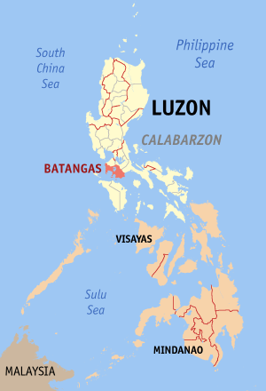
Map of the en:Philippines showing the location of en:Batangas.
Created and copyright (2003) by Eugene Villar (seav).
 |
Permission is granted to copy, distribute and/or modify this document under the terms of the GNU Free Documentation License, Version 1.2 or any later version published by the Free Software Foundation; with no Invariant Sections, no Front-Cover Texts, and no Back-Cover Texts. Subject to disclaimers. Asturianu | Български | Català | Deutsch | English | Español | Français | Gaeilge | Italiano | 한국어 | 日本語 | Polski | Português | Română | Türkçe | +/- |
- 14:33, June 15, 2003 . . Seav (14924 bytes) (More readable map.)
- 03:53, May 24, 2003 . . Seav (12351 bytes) (Map of the Philippines showing the location of Batangas.)
Cronologia di questa immagine
Fare clic su un gruppo data/ora per vedere il file come si presentava nel momento indicato.
| Data | Dimensioni | Utente | Commento | |
|---|---|---|---|---|
| corrente | 09:21, 24 gen 2006 | 300×440 (19 KB) | Magalhães | (updated version) |
| 15:39, 29 lug 2005 | 300×450 (15 KB) | Bluemask | (Source: en:Image:Ph locator map batangas.png Map of the en:Philippines showing the location of en:Batangas. Created and copyright (2003) by Eugene Villar (seav). {{GFDL}} * [http://upload.wikimedia.org/wikipedia/en/f/f) |
Pagine che usano questa immagine
Le pagine seguenti richiamano questa immagine:

