Immagine:Canada provinces 1895-1898.png
Da Wikipedia, l'enciclopedia libera.
Dimensioni di questa anteprima: 694 × 600 pixel
Versione ad alta risoluzione (1.000 × 864 pixel, dimensioni: 46 KB, tipo MIME: image/png)
Questo file e la sua pagina di descrizione si trovano su Wikimedia Commons.
Se non hai mai usato Commons, visita la pagina di benvenuto o leggi le FAQ.
[edit] Summary
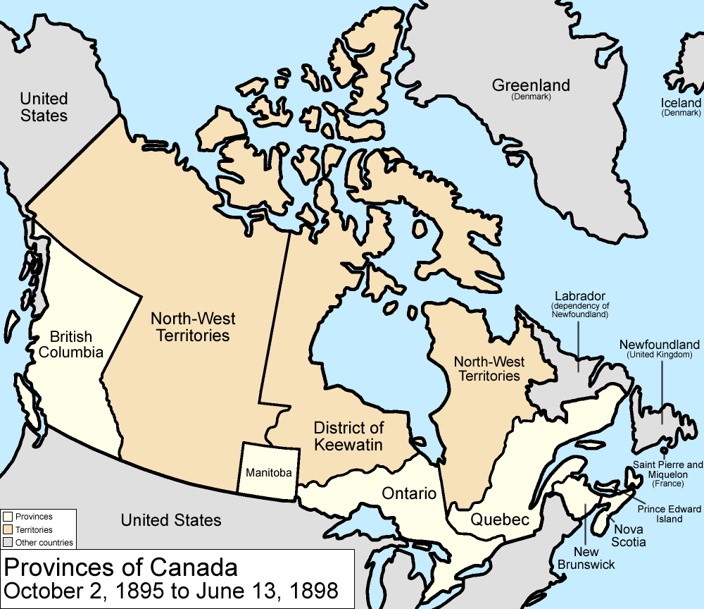
Map of the provinces and territories of Canada as they were from 1895 to 1898. In 1895, the District of Keewatin was enlarged. On June 13 1898, Yukon Territory is formed mostly from the District of Yukon in the North-West Territories, and Quebec is enlarged from land from the North-West Territories.
Made by User:Golbez.
[edit] Licensing
|

Cronologia di questa immagine
Fare clic su un gruppo data/ora per vedere il file come si presentava nel momento indicato.
| Data | Dimensioni | Utente | Commento | |
|---|---|---|---|---|
| corrente | 11:59, 7 ago 2006 | 1.000×864 (46 KB) | Golbez | (with legend) |
| 09:31, 28 mar 2006 | 1.000×864 (45 KB) | Golbez | (fix wrong caption) | |
| 04:24, 18 feb 2006 | 1.000×864 (44 KB) | Golbez | (Better version) | |
| 01:49, 14 feb 2006 | 1.000×864 (40 KB) | Golbez | (better colors) | |
| 11:28, 13 feb 2006 | 1.000×864 (40 KB) | Golbez | (Map of the provinces and territories of Canada as they were from 1895 to 1898. In 1895, the District of Keewatin was enlarged. On June 13 1898, Yukon Territory is formed mostly from the District of Yukon in the North-West Territories, and Quebec is enlarg) |
Pagine che usano questa immagine
Le pagine seguenti richiamano questa immagine:

