Immagine:Canada provinces 1871-1873.png
Da Wikipedia, l'enciclopedia libera.
Dimensioni di questa anteprima: 694 × 600 pixel
Versione ad alta risoluzione (1.000 × 864 pixel, dimensioni: 45 KB, tipo MIME: image/png)
Questo file e la sua pagina di descrizione si trovano su Wikimedia Commons.
Se non hai mai usato Commons, visita la pagina di benvenuto o leggi le FAQ.
[edit] Summary
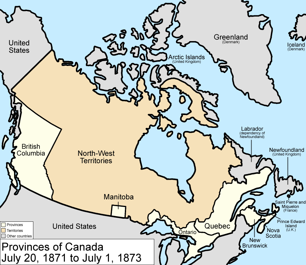
Map of the provinces and territories of Canada as they were from 1871 to 1873. On July 20 1871, British Columbia joined as a province. On July 1 1873, Prince Edward Island joined as a province.
Made by User:Golbez.
[edit] Licensing
|

Cronologia di questa immagine
Fare clic su un gruppo data/ora per vedere il file come si presentava nel momento indicato.
| Data | Dimensioni | Utente | Commento | |
|---|---|---|---|---|
| corrente | 11:59, 7 ago 2006 | 1.000×864 (45 KB) | Golbez | (with legend) |
| 04:24, 18 feb 2006 | 1.000×864 (44 KB) | Golbez | (Better version) | |
| 01:41, 14 feb 2006 | 950×725 (28 KB) | Golbez | (Map of the provinces of Canada as they were from 1871 to 1873. On July 20 1871, British Columbia joined as a province. On July 1 1873, Prince Edward Island joined as a province. Made by User:Golbez. Category:Maps of Canada) |
Pagine che usano questa immagine
Le pagine seguenti richiamano questa immagine:

