Bild:Hamburg.Plan.1890.png
aus Wikipedia, der freien Enzyklopädie
Größe der Voransicht: 800 × 433 Pixel
Version in höherer Auflösung (3.000 × 1.622 Pixel, Dateigröße: 2,39 MB, MIME-Typ: image/png)
| | Diese Datei wird aus dem zentralen, mehrsprachigen Dateiarchiv Wikimedia Commons eingebunden. Sämtliche Informationen unter dem roten Trennstrich stammen von der dortigen Beschreibungsseite der Datei. | |
[edit] Beschreibung
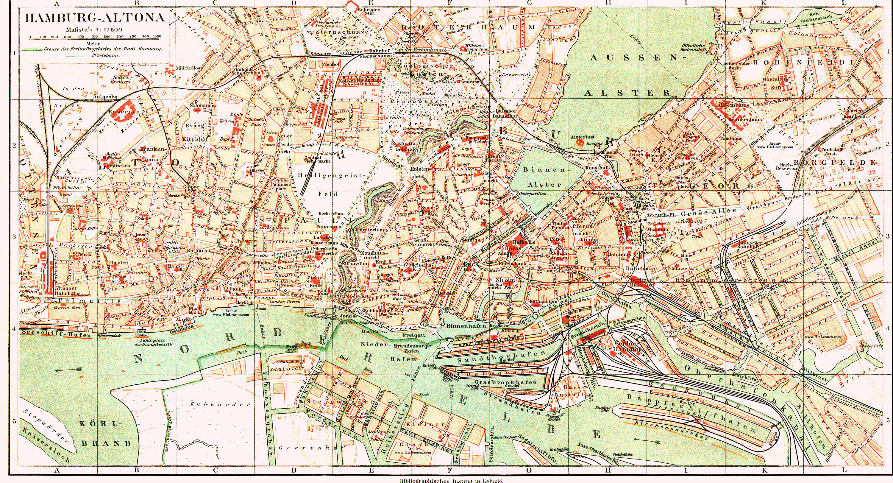
Plan von Hamburg und Altona ca. 1890
Das Rathaus ist bereits vorhanden, die Mönckebergstraße und Hauptbahnhof fehlen noch. Der Bereich um den Meßberg ist noch im alten Zustand.
aus: Ritters geographisch-statistischem Lexikon, Bd. A-K, 8. Aufl. (1895), Ed. J. Penzler, Otto Wiegand, Leipzig, Bibliografisches Institut (→www.HicLeones.com)
[edit] Licensing
| This image (or other media file) is in the public domain because its copyright has expired. This applies to the United States, Canada, the European Union and those countries with a copyright term of life of the author plus 70 years.
العربية | Asturianu | Български | Català | Česky | Dansk | Deutsch | English | Ελληνικά | Esperanto | Español | Euskara | فارسی | Français | Gaeilge | Galego | עברית | हिन्दी | Bahasa Indonesia | Italiano | 日本語 | 한국어 | Kurdî / كوردی | Lietuvių | Magyar | Nederlands | Norsk (nynorsk) | Македонски | Bahasa Melayu | Polski | Português | Română | Русский | Slovenčina | Slovenščina | Shqip | Suomi | Sámegiella | Türkçe | 中文(简体) | 中文(繁體) | 粵語 | +/- |
Dateiversionen
Klicke auf einen Zeitpunkt, um diese Version zu laden.
| Version vom | Maße | Benutzer | Kommentar | |
|---|---|---|---|---|
| aktuell | 20:35, 14. Okt. 2005 | 3.000×1.622 (2,39 MB) | Wmeinhart | (Plan von Hamburg und Altona aus Ritters geographisch-statistischem Lexikon, Bd. A-K, 8. Aufl. (1895), Ed. J. Penzler, Otto Wiegand, Leipzig, Bibligrafisches Institut) |
Verwendung
Die folgenden 8 Seiten verwenden diese Datei:

