
Image:Satellite image of Japan in May 2003.jpg
维基百科,自由的百科全书
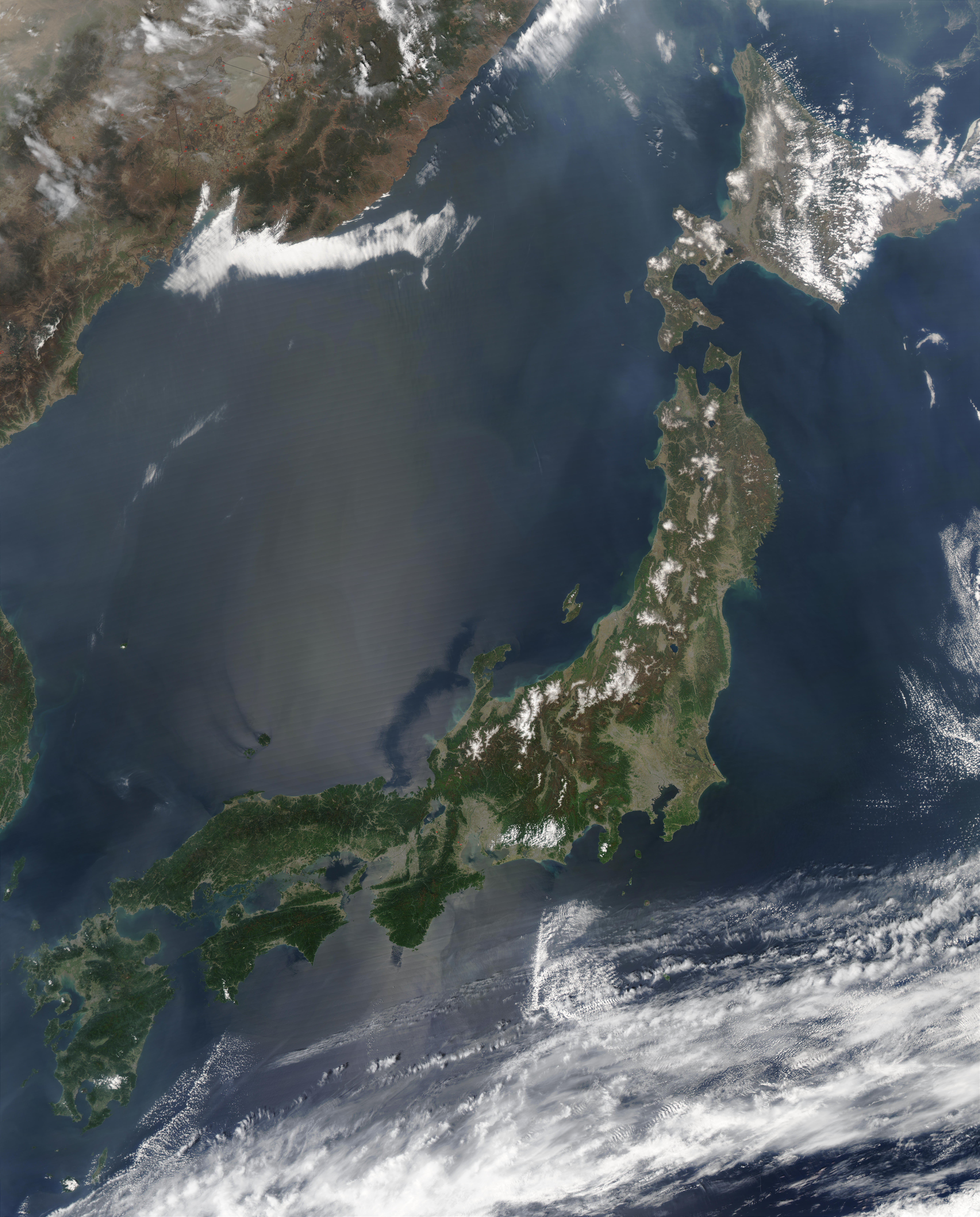
| Description |
Satellite image of Japan in May 2003.
|
|---|---|
| Source |
Cropped from http://visibleearth.nasa.gov/view_rec.php?id=5319 |
| Date |
May 1, 2003 |
| Author |
Jeff Schmaltz, MODIS Rapid Response Team, NASA/GSFC |
| Permission (Reusing this image) |
see below |
[edit] Licensing
|
|
This file is in the public domain because it was created by NASA. NASA copyright policy states that "NASA material is not protected by copyright unless noted". (NASA copyright policy page or JPL Image Use Policy).
Deutsch | English | Español | Français | Nederlands | Português | Русский | 中文(简体) | 中文(繁體) | +/- |
|
 |
Warnings:
|
文件历史
点击日期/时间以查看当时出现过的文件。
| 日期/时间 | 维度 | 用户 | 注解 | |
|---|---|---|---|---|
| 当前 | 2006年3月31日 (五) 10:41 | 5,800×7,200 (3.69 MB) | Hautala | (higher resolution) |
| 2004年12月25日 (六) 14:55 | 2,900×3,600 (1.29 MB) | Hautala | ({{PD-USGov-NASA}} Satellite image of Japan in May 2003. Taken from NASA's Visible Earth http://visibleearth.nasa.gov/cgi-bin/viewrecord?25391 . The islands of Japan are shown clearly off the coast of North and South Korea, China, and Russia in this true-) |
链接
以下页面链接到本图像:

