
Bild:Cape Floral Region Protected Areas map.jpg
Från Wikipedia
Storleken på denna förhandsvisning: 800 × 327 pixlar
Bilden i högre upplösning (2 730 × 1 116 pixel, filstorlek: 561 kbyte, MIME-typ: image/jpeg)
| | Denna fil tillhandahålls av Wikimedia Commons. Informationen från filens beskrivningssida följer nedan. |
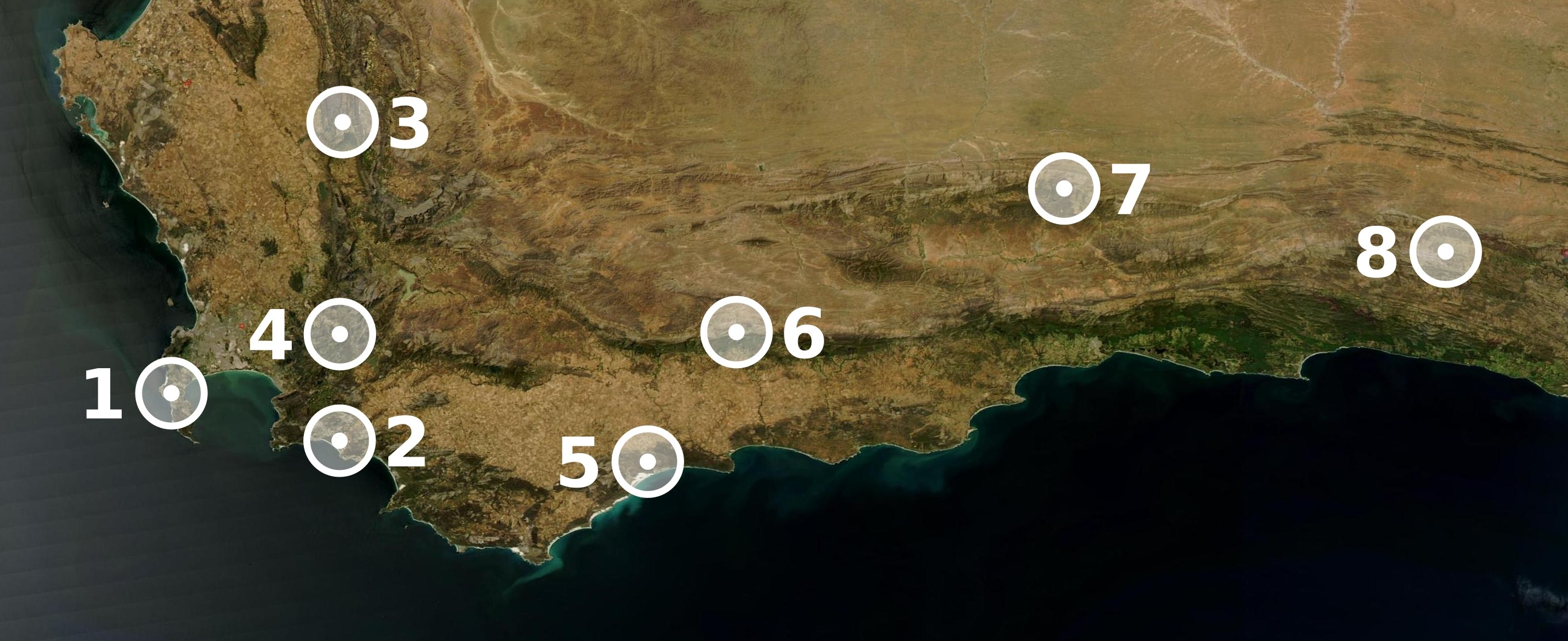
| Description |
Map showing the location of the eight sites included in UNESCO's World Heritage ensemble Cape Floral Region Protected Areas. (1): Cape Peninsula National Park; (2): Groot Winterhoek Wilderness Area; (3): Cederberg Wilderness Area; (4): Boland Mountain Complex; (5): De Hoop Nature Reserve; (6): Boosmansbos Nature Reserve; (7) Swartberg Complex; (8): Baviaanskloof |
|---|---|
| Source |
Map made with The GIMP and Inkscape from a public domain image out of NASA's World Wind. |
| Date |
07 November 2005 |
| Author | |
| Permission (Reusing this image) |
See below. |
| This file is licensed under the Creative Commons Attribution ShareAlike 2.5 License. In short: you are free to share and make derivative works of the file under the conditions that you appropriately attribute it, and that you distribute it only under a license identical to this one. Official license |
Filhistorik
Klicka på ett datum för att se hur filen såg ut vid den tidpunkten.
| Datum | Dimensioner | Användare | Kommentar | |
|---|---|---|---|---|
| nuvarande | 9 november 2005 kl. 01.06 | 2 730×1 116 (561 kbyte) | Tintazul | (Markers in white instead of red: better visibility, less JPEG artifact) |
| 7 november 2005 kl. 18.59 | 2 730×1 017 (777 kbyte) | Tintazul | ({{Information| |Description=Map showing the location of the eight sites included in UNESCO's World Heritage ensemble '''Cape Floral Region Protected Areas'''. |Source=Map made with The GIMP and Inkscape from a public domain image by NASA. |Date=07 Novembe) |
Bildlänkar
Följande sidor länkar till denna bild:

