Изображение:Chicxulub radar topography.jpg
Материал из Википедии — свободной энциклопедии
Размер при предпросмотре: 536 × 599 пикселов
Изображение в более высоком разрешении (715 × 799 пикселов, размер файла: 119 КБ, MIME-тип: image/jpeg)
| Cведения об этом файле находятся на Викискладе?, хранилище изображений и мультимедиа для использования во всех проектах Фонда Викимедиа |
Содержимое его страницы описания показано ниже.
| Description |
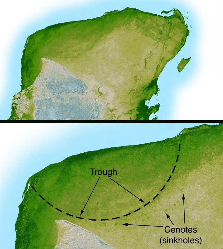
English: This shaded relief image of Mexico's Yucatan Peninsula show a subtle, but unmistakable, indication of the Chicxulub impact crater. Most scientists now agree that this impact was the cause of the Cretatious-Tertiary Extinction, the event 65 million years ago that marked the sudden extinction of the dinosaurs as well as the majority of life then on Earth.
|
|---|---|
| Source |
http://photojournal.jpl.nasa.gov/catalog/PIA03379
|
| Date |
February 2000 |
| Author |
NASA/JPL-Caltech |
| Permission (Reusing this image) |
PD-USGOV-NASA. |
| Other versions | version with more labels and scale indicators |
| This image or video was catalogued by Jet Propulsion Lab of the United States National Aeronautics and Space Administration (NASA) under Photo ID: PIA03379. This tag does not indicate the copyright status or the source of the attached work. A normal copyright tag and a source are still required. See Commons:Licensing for more information. |
[edit] License information
|
|
This file is in the public domain because it was created by NASA. NASA copyright policy states that "NASA material is not protected by copyright unless noted". (NASA copyright policy page or JPL Image Use Policy).
Deutsch | English | Español | Français | Nederlands | Português | Русский | 中文(简体) | 中文(繁體) | +/- |
|
 |
Warnings:
|
История файла
Нажмите на дату/время, чтобы посмотреть файл, который был загружен в тот момент.
| Дата/время | Разрешение | Участник | Примечание | |
|---|---|---|---|---|
| текущий | 04:38, 11 сентября 2005 | 715 × 799 (119 КБ) | Miya | (This image is originally uploaded to English Wikipedia with the informaion as follows: {{PD}}Radar topography (color corresponds to height) of the {{PD}}Yucatán peninsula, revealing the en:Chicxulub Crater. Courtesy NASA/JPL-Caltech (it is ) |
Ссылки
Следующие страницы ссылаются на данный файл:

