
Imagem:GreaterAmericaMap.jpg
Origem: Wikipédia, a enciclopédia livre.
Resolução maior não disponível.
GreaterAmericaMap.jpg (571 × 391 pixel, tamanho do ficheiro: 70 KB, tipo MIME: image/jpeg)
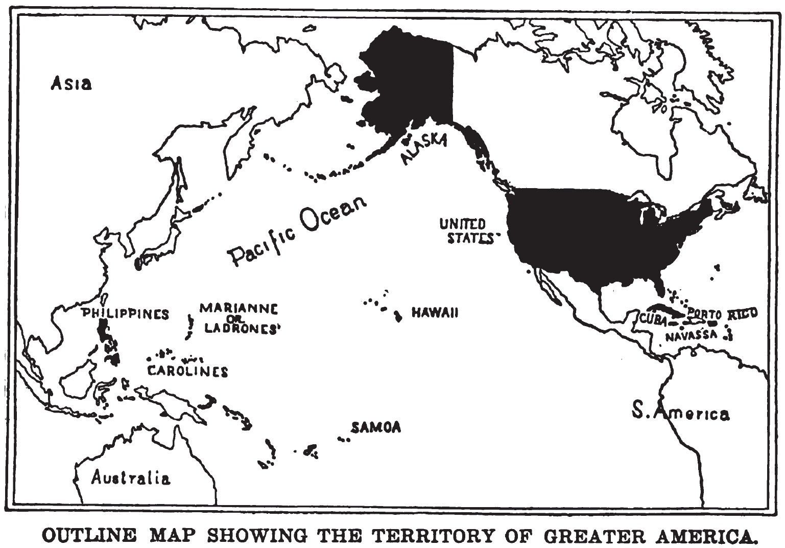
Map of "Greater America", 1899.
Shows territories and possessions of the United States after the Spanish American War, including Alaska, Cuba, Hawaii, Marianas, Philippines, Puerto Rico, and Samoa in addition to the continental United States.
|
|
This media file is in the public domain in the United States. This applies to U.S. works where the copyright has expired, often because its first publication occurred prior to January 1, 1923. See this page for further explanation.
|
|
|
Deutsch | English | Español | Français | Gaeilge | Galego | Italiano | Nederlands | 中文(简体) | +/- |
||
|
|
This image might not be in the public domain outside of the United States (this especially applies in Canada, China (not Hong Kong, Macao, or Taiwan Area), Germany, Mexico, and Switzerland). The creator and year of publication are essential information and must be provided. See Wikipedia:Public domain and Wikipedia:Copyrights for more details. |
Scanned from original 1899 printing by Infrogmation, previously uploaded by him to en:Wikipedia 23:36, 22 October 2003
Histórico do ficheiro
Clique em uma data/horário para ver o ficheiro tal como ele se encontrava em tal momento.
| Data/Horário | Dimensões | Utilizador | Comentário | |
|---|---|---|---|---|
| actual | 12h55min de 23 de Maio de 2005 | 571×391 (70 KB) | Shizhao | (Map of "Greater America", scanned from 1899 book. Shows territories and possessions of the United States after the Spanish American War, including Alaska, Cuba, Hawaii, Marianas, Philippines, Puerto Rico, and Samoa) |
Ligações
As seguintes páginas apontam para este ficheiro:

