Grafika:Schuylkillmap.png
Z Wikipedii
Rozmiar podglądu: 597 × 600 pikseli
Obraz w wyższej rozdzielczości (600 × 603 pikseli, rozmiar pliku: 163 kB, typ MIME: image/png)
| | Plik Schuylkillmap.png [ edytuj opis ] umieszczony jest w Wikimedia Commons, repozytorium wolnych zasobów projektów Fundacji Wikimedia. Wyjaśnienie podanej poniżej licencji znajdziesz na stronie Opisy licencji grafiki. |
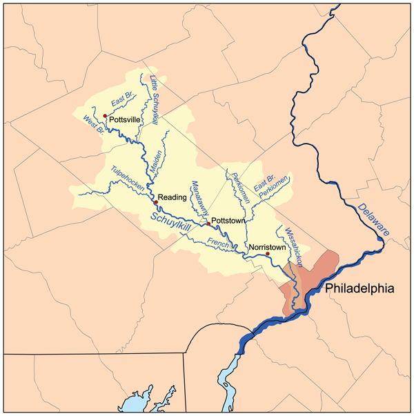
This is a map of the Schuylkill River Watershed. I, Karl Musser, created it based on USGS data.
|
Historia pliku
Kliknij na datę/czas, aby zobaczyć, jak plik wyglądał w tym czasie.
| Data/czas | Wymiary | Użytkownik | Opis | |
|---|---|---|---|---|
| aktualny | 23:10, 26 gru 2006 | 600×603 (163 kB) | Kmusser | (This is a map of the Schuylkill River Watershed. I, Karl Musser, created it based on USGS data. {{self|cc-by-sa-2.5}} Category:Maps of rivers of the United States) |
Odnośniki do pliku
Następujące strony odwołują się do tego pliku:

