See also ebooksgratis.com: no banners, no cookies, totally FREE.

CLASSICISTRANIERI HOME PAGE - YOUTUBE CHANNEL
Privacy Policy Cookie Policy Terms and Conditions
Grafika:Corfu topographic map-en.svg - Wikipedia, wolna encyklopedia

Grafika:Corfu topographic map-en.svg

Z Wikipedii

Corfu_topographic_map-en.svg (Plik SVG, rozmiar bazowy 2100 × 2345 pikseli, rozmiar pliku: 3,17 MB)

 
Commons
Ta grafika zawiera tekst w obcym języku i należy go przetłumaczyć. Jeżeli pojęcia są niejednoznaczne, poproś o współpracę osobę z odpowiedniego Wikiprojektu.

Rozważ, czy nie lepiej byłoby zamiast podmieniania tekstu na język polski, użyć odpowiednich znaków, np. liczbowych i zrobić legendę na stronie grafiki.


Pour agrandir l'image

Detailed map of large dimension. For a better viewing, click on the link of the image above.
Carte détaillée de grande dimension. Pour une visualisation optimale, cliquer sur le lien de l'image ci-dessus.

[edit] Summary

POTY
Featured picture
This file was a candidate on Picture of the Year 2007.
This is a featured picture on Wikimedia Commons: it is considered one of our finest images.
If you have an image of similar quality that can be published under a suitable copyright license, be sure to upload it, tag it, and nominate it.
Wikimedia Commons
Description
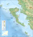
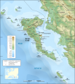
English: Topographic map in English of the Corfu island area in Greece.
Português: Mapa topográfico, em Inglês, da área da ilha de Corfu, na Grécia.
Source

Own work ;
Background map : NASA Shuttle Radar Topography Mission (SRTM3 v.2) (public domain) edited with 3DEM from Visualization Software LLC and vectorized with Inkscape ; UTM projection ; WGS84 datum ; shaded relief (composite image of N-W, W and N lightning positions) ;
Bathymetry : USGov public domain data provided by the Demis add-on for World Wind (see the approval e-mail) ;
Approximate scale of topographic data and shore / lakes limits : 1:372,000 ; of the bathymetry : 1:3.720.000
Locator map : Image:Europe_countries.svg (modified) created by Júlio Reis under CC-BY-SA ;
Other references used for additional data :
* NASA World Wind ;
* Maps available on Corfougrece.free.fr ;
* Map available on Corfu-hotels.us ;
* Maps of Greece and Albania from the site of the University of Texas ;
* ViaMichelin ;
* Microsoft Encarta atlas (1999 edition).
Note : The shaded relief is a raster image embedded in the SVG file which increases its size. If you want a lighter map (about 1 120 ko) for other purposes, delete the shaded relief image in your file.

Date

March 2007

Author

Eric Gaba (Sting)

Permission
(Reusing this image)

GFDL + CC-BY-SA

Other versions

[edit]


Français :
  • Sujet : Carte topographique en anglais de la zone de l'île de Corfou en Grèce ;
  • Source : Réalisation personnelle ;
  • Fond de carte : NASA Shuttle Radar Topography Mission (SRTM3 v.2) (domaine public) édité avec 3DEM de Visualization Software LLC et vectorisé avec Inkscape ; projection UTM ; WGS84 datum ; relief ombré (image composite d'éclairages du N-O, O et N) ;
  • Bathymétrie : Données du gouvernement des ÉUA dans le domaine public fournies par l'add-on Demis pour World Wind (voir le courriel d'approbation) ;
  • Carte de localisation : Image:Europe_countries.svg (modifiée) créée par Júlio Reis sous CC-BY-SA ;
  • Autres références utilisées pour les données complémentaires :
  • Échelle approximative :
  • 1:372 000 (données topographiques et tracés des côtes / lacs) ;
  • 1:3 720 000 (bathymétrie) ;
  • Note : Le relief ombré est une image bitmap encapsulée dans le fichier SVG qui augmente son poids. Si vous avez besoin d'une carte plus légère (environ 1 120 ko) pour d'autres utilisations, supprimez l'image du relief ombré dans votre fichier ;
  • Auteur : Eric Gaba (fr:Sting) ;
  • Date : Mars 2007 ;
  • Autres versions :


Atelier graphique
Remarque
English: This map was made or improved by the Wikigraphists of the Atelier graphique. You can propose maps or images to clean up and improve as well.
Esperanto: Ĉi tiu mapo estis kreita aŭ plibonigita de la Vikigrafistoj el la Grafika laborgrupo. Vi ankaŭ povas tie proponi mapojnbildojn plibonigendajn.
Español: Este mapa ha sido confeccionado o mejorado por los Wikígrafos del Taller gráfico. Puedes proponer la mejora de cualquier imagen a través de la página de Peticiones.
Français : Cette carte a été créée ou améliorée par les Wikigraphistes de l'Atelier graphique. Vous pouvez également y proposer des cartes ou des images à améliorer.
Türkçe: Bu harita Atelier graphique'ten Wikigraphistes'ler tarafından yapıldı veya geliştirildi. Siz de haritalar veya resimleri temizlemek veya geliştirmek için teklif edebilirsiniz.
This SVG file uses embedded text that can be easily translated into your language. Learn more.

For SVG images, you can use this page to translate it into your language.


العربية | Català | Dansk | Deutsch | English | Esperanto | Español | Français | Galego | Italiano | 日本語 | Lietuvių | Magyar | Nederlands | Polski | Português | Русский | Svenska | Українська | +/-

[edit] Licensing

I, the copyright holder of this work, hereby publish it under the following licenses:
GNU head Permission is granted to copy, distribute and/or modify this document under the terms of the GNU Free Documentation license, Version 1.2 or any later version published by the Free Software Foundation; with no Invariant Sections, no Front-Cover Texts, and no Back-Cover Texts. A copy of the license is included in the section entitled "GNU Free Documentation license".

Aragonés | العربية | Asturianu | Български | বাংলা | ইমার ঠার/বিষ্ণুপ্রিয়া মণিপুরী | Brezhoneg | Bosanski | Català | Cebuano | Česky | Dansk | Deutsch | Ελληνικά | English | Esperanto | Español | Eesti | Euskara | فارسی | Suomi | Français | Gaeilge | Galego | עברית | Hrvatski | Magyar | Bahasa Indonesia | Ido | Íslenska | Italiano | 日本語 | ქართული | ភាសាខ្មែរ | 한국어 | Kurdî / كوردی | Latina | Lëtzebuergesch | Lietuvių | Bahasa Melayu | Nnapulitano | Nederlands | ‪Norsk (nynorsk)‬ | ‪Norsk (bokmål)‬ | Occitan | Polski | Português | Română | Русский | Slovenčina | Slovenščina | Shqip | Српски / Srpski | Svenska | తెలుగు | ไทย | Türkçe | Українська | اردو | Tiếng Việt | Volapük | Yorùbá | ‪中文(中国大陆)‬ | ‪中文(台灣)‬ | +/-

Some rights reserved
Creative Commons Attribution iconCreative Commons Share Alike icon
This file is licensed under the Creative Commons Attribution ShareAlike license versions 2.5, 2.0, and 1.0

العربية | Български | Català | Česky | Dansk | Deutsch | English | Español | Euskara | فارسی | Français | עברית | Italiano | 日本語 | 한국어 | Lietuvių | Nederlands | Polski | Português | Русский | Svenska | தமிழ் | Türkçe | 中文 | 中文 | +/-

You may select the license of your choice.

Historia pliku

Kliknij na datę/czas, aby zobaczyć, jak plik wyglądał w tym czasie.

Data/czasWymiaryUżytkownikOpis
aktualny20:59, 29 paź 20072 100×2 345 (3,17 MB)Sting ("Pavllo" river name correction ; + river names on Corfu island ; key more complete)
03:05, 16 maj 20072 100×2 345 (3,14 MB)Sting (International elevation key)
03:07, 30 mar 20072 100×2 345 (3,14 MB)Sting ({{Information| |Description=Topographic map in French of the Corfu island area in Greece. |Source=Own work ;<br/>Background map : [http://www2.jpl.nasa.gov/srtm NASA Shuttle Radar Topography Mission] (SRTM3 v.2) (public domain) edited with [)


aa - ab - af - ak - als - am - an - ang - ar - arc - as - ast - av - ay - az - ba - bar - bat_smg - bcl - be - be_x_old - bg - bh - bi - bm - bn - bo - bpy - br - bs - bug - bxr - ca - cbk_zam - cdo - ce - ceb - ch - cho - chr - chy - co - cr - crh - cs - csb - cu - cv - cy - da - de - diq - dsb - dv - dz - ee - el - eml - en - eo - es - et - eu - ext - fa - ff - fi - fiu_vro - fj - fo - fr - frp - fur - fy - ga - gan - gd - gl - glk - gn - got - gu - gv - ha - hak - haw - he - hi - hif - ho - hr - hsb - ht - hu - hy - hz - ia - id - ie - ig - ii - ik - ilo - io - is - it - iu - ja - jbo - jv - ka - kaa - kab - kg - ki - kj - kk - kl - km - kn - ko - kr - ks - ksh - ku - kv - kw - ky - la - lad - lb - lbe - lg - li - lij - lmo - ln - lo - lt - lv - map_bms - mdf - mg - mh - mi - mk - ml - mn - mo - mr - mt - mus - my - myv - mzn - na - nah - nap - nds - nds_nl - ne - new - ng - nl - nn - no - nov - nrm - nv - ny - oc - om - or - os - pa - pag - pam - pap - pdc - pi - pih - pl - pms - ps - pt - qu - quality - rm - rmy - rn - ro - roa_rup - roa_tara - ru - rw - sa - sah - sc - scn - sco - sd - se - sg - sh - si - simple - sk - sl - sm - sn - so - sr - srn - ss - st - stq - su - sv - sw - szl - ta - te - tet - tg - th - ti - tk - tl - tlh - tn - to - tpi - tr - ts - tt - tum - tw - ty - udm - ug - uk - ur - uz - ve - vec - vi - vls - vo - wa - war - wo - wuu - xal - xh - yi - yo - za - zea - zh - zh_classical - zh_min_nan - zh_yue - zu -