
Image:LocationMauritania.png
Fro Wikipedia
No higher resolution available.
LocationMauritania.png (250 × 115 pixel, file size: 6 KB, MIME type: image/png)
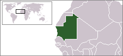
Location map for the Mauritania.
Originally created for English Wikipedia by Vardion.
| This image has been (or is hereby) released into the public domain by its author, Vardion at the English Wikipedia project. This applies worldwide. In case this is not legally possible: |
 A vector version of this image (SVG) is available. For more information about vector graphics, read about Commons transition to SVG. Български | Deutsch | English | Español | Français | Galego | עברית | Magyar | Bahasa Indonesia | Italiano | 日本語 | 한국어 | Lietuvių | Polski | Português | Русский | Српски / Srpski | Українська | 中文(简体) | 中文(繁體) | +/- |
 |
File history
Click on a date/time to view the file as it appeared at that time.
| Date/Time | Dimensions | Usere | Comment | |
|---|---|---|---|---|
| current | 14:29, 4 desembre 2007 | 250×115 (6 KB) | Gandal el gris | (Reverted to version as of 07:01, 19 November 2007) |
| 11:29, 4 desembre 2007 | 250×115 (5 KB) | Tetouancity | (Reverted to version as of 15:01, 14 November 2007) | |
| 07:01, 19 novembre 2007 | 250×115 (6 KB) | Gandal el gris | ||
| 15:01, 14 novembre 2007 | 250×115 (5 KB) | Vispec | (Reverted to version as of 12:31, 11 November 2007) | |
| 14:34, 12 novembre 2007 | 250×115 (6 KB) | CHV | (Reverted to version as of 18:22, 12 December 2004) | |
| 12:31, 11 novembre 2007 | 250×115 (5 KB) | Vispec | ||
| 18:22, 12 desembre 2004 | 250×115 (6 KB) | EugeneZelenko | (Location map for the Mauritania.<br/>Originally created for English Wikipedia by Vardion.<br/>{{PD}}<br/>Category:Country locator maps) |
Linkes
The following page links to this file:

