
Afbeelding:Map of Helena, Montana (1899).jpg
Uit Wikipedia, de vrije encyclopedie

Grootte van deze afbeelding: 769 × 600 pixels
Afbeelding in hogere resolutie (1.404 × 1.095 pixels, bestandsgrootte: 453 kB, MIME-type: image/jpeg)
| | Dit is een bestand van Wikimedia Commons. Onderstaande beschrijving komt van de beschrijving van het bestand daar. Controleer het gebruik van dit bestand in andere Wikimediaprojecten. |
[edit] Summary
| Description | |
|---|---|
| Source | |
| Date |
1899 |
| Author |
US Geological Survey |
| Permission (Reusing this image) |
see below |
[edit] Licensing
| This image (or other media file) is in the public domain because its copyright has expired. This applies to the United States, Canada, the European Union and those countries with a copyright term of life of the author plus 70 years.
العربية | Asturianu | Български | Català | Česky | Dansk | Deutsch | English | Ελληνικά | Esperanto | Español | Euskara | فارسی | Français | Gaeilge | Galego | עברית | हिन्दी | Bahasa Indonesia | Italiano | 日本語 | 한국어 | Kurdî / كوردی | Lietuvių | Magyar | Nederlands | Norsk (nynorsk) | Македонски | Bahasa Melayu | Polski | Português | Română | Русский | Slovenčina | Slovenščina | Shqip | Suomi | Sámegiella | Türkçe | 中文(简体) | 中文(繁體) | 粵語 | +/- |
Bestandsgeschiedenis
Klik op een datum/tijd om het bestand te zien zoals het destijds was.
| Datum/tijd | Afmetingen | Gebruiker | Opmerking | |
|---|---|---|---|---|
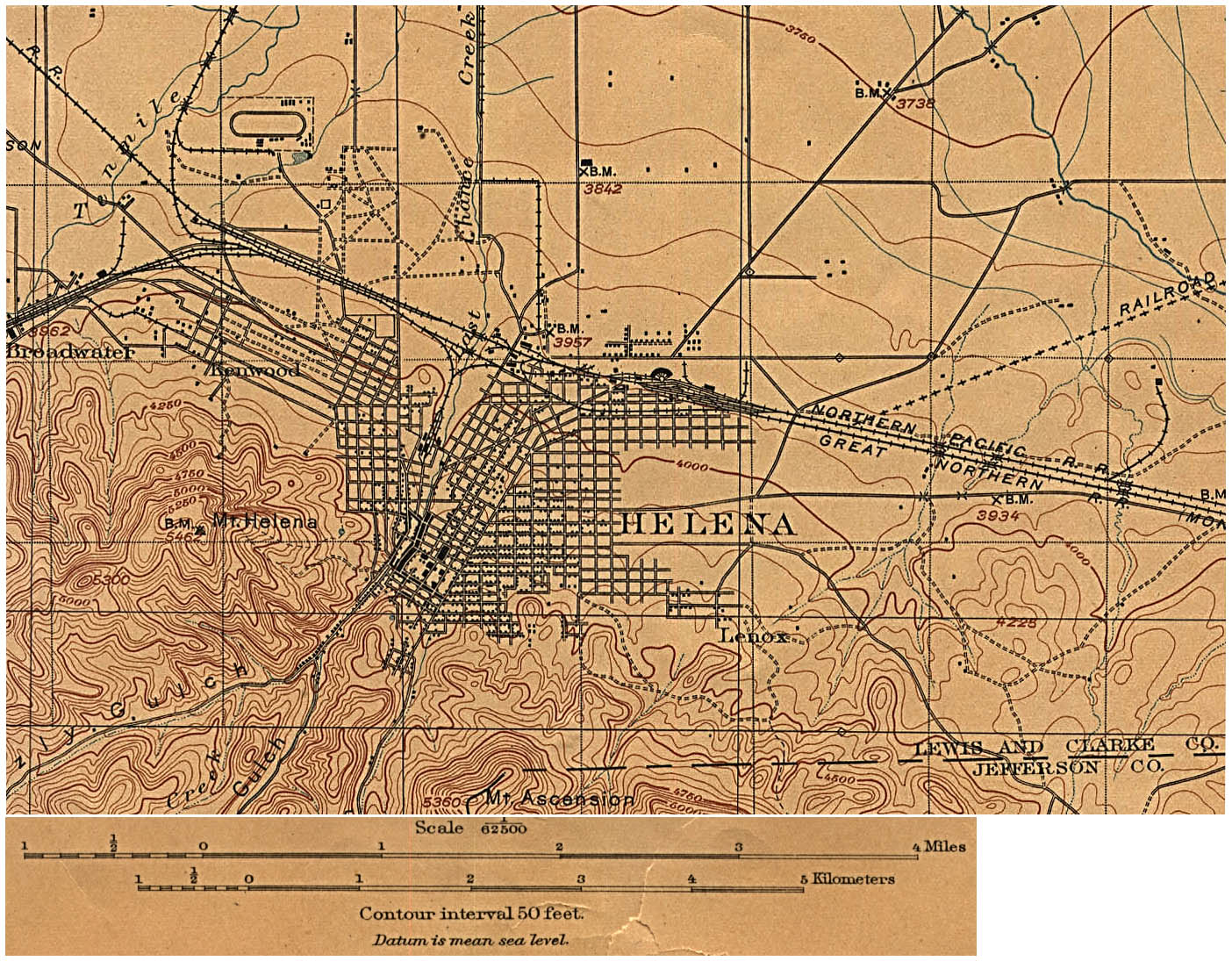
| huidige versie | 6 mei 2008 21:56 | 1.404x1.095 (453 kB) | Kameraad Pjotr | ({{Information |Description={{en|Map of the citiy of Helena, Montana, Montana in 1899.}} |Source=[http://www.lib.utexas.edu/maps/historical/helena_mt_1899.jpg U.S. Geological Survey edition of 1899, reprinted 1906.] |Date=1899 |Author=US Geologica) |
Bestandsverwijzingen
Dit bestand wordt op de volgende 3 pagina's gebruikt:

