
Afbeelding:Alba Patera - topography map.png
Uit Wikipedia, de vrije encyclopedie
Grootte van deze afbeelding: 601 × 599 pixels
Afbeelding in hogere resolutie (623 × 621 pixels, bestandsgrootte: 395 kB, MIME-type: image/png)
| | Dit is een bestand van Wikimedia Commons. Onderstaande beschrijving komt van de beschrijving van het bestand daar. Controleer het gebruik van dit bestand in andere Wikimediaprojecten. |
| Description |
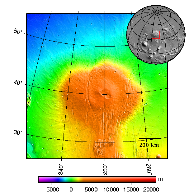
Česky: Štítová sopka Alba Patera na Marsu - topografická mapa
English: Topography map of shield vulcano Alba Patera on Mars
|
|---|---|
| Source |
plotted using GMT and gridded MOLA data archive meg0031t.grd |
| Date |
2008-03-see below |
| Author | |
| Permission (Reusing this image) |
|

Bestandsgeschiedenis
Klik op een datum/tijd om het bestand te zien zoals het destijds was.
| Datum/tijd | Afmetingen | Gebruiker | Opmerking | |
|---|---|---|---|---|
| huidige versie | 11 mrt 2008 00:48 | 623x621 (395 kB) | Chmee2 | ({{Information |Description={{cs|Štítová sopka Alba Patera na Marsu - topografická mapa}} {{en|Topography map of shield vulcano Alba Patera on Mars}} |Source=plotted using GMT and gridded MOLA data archive meg0031t.grd |Date=2008-03-see below |Author=[) |
Bestandsverwijzingen
Dit bestand wordt op de volgende pagina gebruikt:

