Imago:SeptinsularRepublic1801.jpg
E Vicipaedia
No higher resolution available.
SeptinsularRepublic1801.jpg (416 × 424 pixel, file size: 103 chiliocteti, MIME type: image/jpeg)
| | Hic est fasciculus ex Vicimediis Communibus. Vide eius descriptionem apud Communia ut plura discas. |

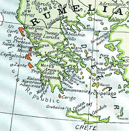
Septinsular Republic (yellow) in 1801, on the 19th century map of Ottoman Empire (green)
| This image (or other media file) is in the public domain because its copyright has expired. This applies to the United States, Canada, the European Union and those countries with a copyright term of life of the author plus 70 years.
العربية | Asturianu | Български | Català | Česky | Dansk | Deutsch | English | Ελληνικά | Esperanto | Español | Euskara | فارسی | Français | Gaeilge | Galego | עברית | हिन्दी | Bahasa Indonesia | Italiano | 日本語 | 한국어 | Kurdî / كوردی | Lietuvių | Magyar | Nederlands | Norsk (nynorsk) | Македонски | Bahasa Melayu | Polski | Português | Română | Русский | Slovenčina | Slovenščina | Shqip | Suomi | Sámegiella | Türkçe | 中文(简体) | 中文(繁體) | 粵語 | +/- |
Historia fasciculi
Ad emendationem fasciculi inspiciendum, preme in diem/tempus.
| Dies/Tempus | Dimensiones | Usor | Summarium | |
|---|---|---|---|---|
| recentissima | 09:06, 11 Martii 2006 | 416×424 (103 chiliocteti) | Julo | (thumb Septinsular Republic (yellow) in 1801, on the 19th century map of Ottoman Empire (green) {{PD-old}} category:19th century mapsCategory:Historical maps of the BalkansCategory:Historical maps of Greece) |
Nexus
Paginae sequentes ad hunc fasciculum nectunt:
Metadata
This file contains additional information, probably added from the digital camera or scanner used to create or digitize it. If the file has been modified from its original state, some details may not fully reflect the modified file.
| Orientation | Normal |
|---|---|
| Horizontal resolution | 200 dpi |
| Vertical resolution | 200 dpi |
| Software used | Adobe Photoshop 7.0 |
| File change date and time | 14:37, 28 Septembris 2003 |
| Color space | 65535 |

