그림:Flores map.png
위키백과 ― 우리 모두의 백과사전.
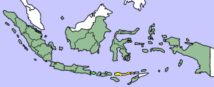
This image was copied from wikipedia:en. The original description was:
Map showing Flores Island within Indonesia
| This file has been released into the public domain by the copyright holder, its copyright has expired, or it is ineligible for copyright. This applies worldwide. | |
Note: This tag is obsolete! Nothing is public domain without a reason. Don't use this generic template - please use instead:
العربية | Български | Česky | Deutsch | English | Español | Français | हिन्दी | Italiano | 日本語 | Norsk (bokmål) | Norsk (nynorsk) | Português | Русский | Slovenčina | Slovenščina | Српски / Srpski | Polski | Türkçe | 中文 | +/- |
| date/time | username | edit summary |
|---|---|---|
| 14:17, 14 March 2005 | *drew | (Map showing Flores Island within Indonesia {{PD}}) |
파일 역사
날짜/시간을 누르면 당시의 파일을 볼 수 있습니다.
| 날짜/시간 | 크기 | 사용자 | 내용 | |
|---|---|---|---|---|
| 현재 | 2007년 2월 2일 (금) 19:19 | 300×122 (21 KB) | J. Patrick Fischer | (The original image was copied from wikipedia:en. The image was corrected by user:J. Patrick Fischer (two islands east of Flores were wrong marked as part of Flores before). The original description was: Map showing Flores Island within Indonesia {{) |
| 2006년 10월 10일 (화) 21:26 | 300×122 (16 KB) | UtherSRG | (Change color.) | |
| 2005년 10월 5일 (수) 21:27 | 300×122 (15 KB) | ChongDae | (This image was copied from wikipedia:en. The original description was: Map showing Flores Island within Indonesia {{PD}} {| border="1" ! date/time || username || edit summary |---- | 14:17, 14 March 2005 || *drew || <nowiki>(Map showing Flores Island wi) |
그림 링크
다음 1개의 문서가 이 그림을 사용하고 있습니다:

