
Berkas:Sumba Topography.png
Dari Wikipedia Indonesia, ensiklopedia bebas berbahasa Indonesia.
Ukuran pratayang ini: 800 × 554 piksel
Resolusi penuh (2.119 × 1.467 piksel, ukuran berkas: 1,4 MB, tipe MIME: image/png)
| | Berkas ini berasal dari Wikimedia Commons. Berikut ini adalah deskripsi berkas dari halaman deskripsi di sana. |
[edit] Summary
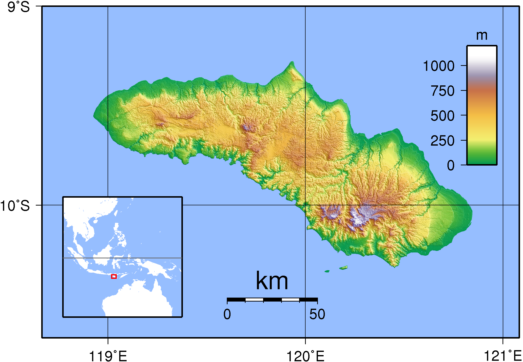
| Description |
Topographic map of Sumba. Created with GMT from SRTM data. |
|---|---|
| Source |
self-made |
| Date |
Sep 11, 2007 |
| Author | |
| Permission (Reusing this image) |
see below |
[edit] Licensing

Riwayat berkas
Klik pada tanggal/waktu untuk melihat berkas ini pada saat tersebut.
| Tanggal/Waktu | Dimensi | Pengguna | Komentar | |
|---|---|---|---|---|
| saat ini | 20:56, 11 September 2007 | 2.119×1.467 (1,4 MB) | Sadalmelik | ({{Information |Description=Topographic map of Sumba. Created with GMT from SRTM data. |Source=self-made |Date=Sep 11, 2007 |Author= Sadalmelik }} Category:Maps of Indonesia Category:Topographic maps of Asia ) |
Pranala
Halaman berikut memiliki pranala ke berkas ini:

