Image:VAMap-doton-Williamsburg.PNG
Un article de Wikipédia, l'encyclopédie libre.
Pas de plus haute résolution disponible.
VAMap-doton-Williamsburg.PNG (300 × 134 pixels, taille du fichier : 9 Kio, type MIME : image/png)
| | Ce fichier provient de Wikimedia Commons?. Les informations le concernant sont affichées ci-dessous (procédure). |
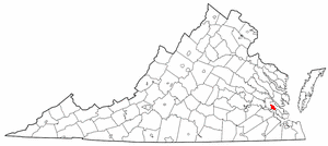
| Description |
Adapted from Wikipedia's VA county maps by Seth Ilys. |
|---|---|
| Source |
Originally from en.wikipedia; description page is/was here. |
| Date |
2005-05-21 (original upload date) |
| Author |
Original uploader was Seth Ilys at en.wikipedia |
| Permission (Reusing this image) |
Released under the GNU Free Documentation License. |
[edit] License information
 |
Permission is granted to copy, distribute and/or modify this document under the terms of the GNU Free Documentation License, Version 1.2 or any later version published by the Free Software Foundation; with no Invariant Sections, no Front-Cover Texts, and no Back-Cover Texts. Subject to disclaimers. Asturianu | Български | Català | Deutsch | English | Español | Français | Gaeilge | Italiano | 한국어 | 日本語 | Polski | Português | Română | Türkçe | +/- |
[edit] Original upload log
(All user names refer to en.wikipedia)
- 2005-05-21 22:44 Seth Ilys 300×134×8 (8887 bytes) {{GFDL}}<br>Adapted from Wikipedia's VA county maps by [[User:Seth Ilys|Seth Ilys]].
Historique du fichier
Cliquer sur une date et une heure pour voir le fichier tel qu’il était à ce moment-là
| Date et heure | Dimensions | Utilisateur | Commentaire | |
|---|---|---|---|---|
| actuel | 10 octobre 2006 à 19:37 | 300×134 (9 Kio) | Haiaw | (Adapted from Wikipedia's VA county maps by Seth Ilys. Copied from english wiki.. {{Information |Description= Williamsburg,VA on Virginia map |Source= en.wikipedia.org |Date= 10/10/2006 |Author= Seth Ilys |Permission= |other_versions= }}) |
Pages contenant l’image
La page ci-dessous contient cette image :

