Image:Santa Monica Bay Map.jpg
Un article de Wikipédia, l'encyclopédie libre.
Pas de plus haute résolution disponible.
Santa_Monica_Bay_Map.jpg (468 × 597 pixels, taille du fichier : 283 Kio, type MIME : image/jpeg)
| | Ce fichier provient de Wikimedia Commons?. Les informations le concernant sont affichées ci-dessous (procédure). |
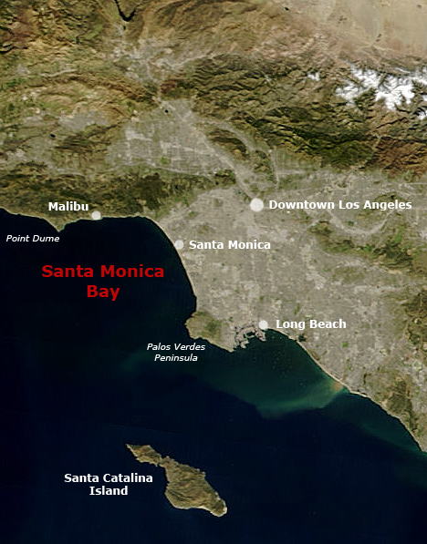
[edit] Summary
following the original text out of the english wikipedia, where it was originally uploaded: Map of Southern California with Santa Monica Bay identified
Underlying map is an aerial map obtained from NASA (original:
http://earthobservatory.nasa.gov/NaturalHazards/Archive/Nov2004/California_TMO_2004304_lrg.jpeg
The labeling is by en:User:Mikeetc
[edit] Licensing
| This work is in the public domain in the United States because it is a work of the United States Federal Government under the terms of Title 17, Chapter 1, Section 105 of the US Code. See Copyright.
Note: This only applies to works of the Federal Government and not to the work of any individual U.S. state, territory, commonwealth, county, municipality, or any other subdivision. العربية | Български | Česky | Deutsch | English | Español | Français | Magyar | Italiano | 日本語 | 한국어 | Polski | Português | 中文(繁體) | 中文(简体) | +/- |
 |
Historique du fichier
Cliquer sur une date et une heure pour voir le fichier tel qu’il était à ce moment-là
| Date et heure | Dimensions | Utilisateur | Commentaire | |
|---|---|---|---|---|
| actuel | 29 mai 2006 à 01:55 | 468×597 (283 Kio) | Otto Normalverbraucher | (following the original text out of the english wikipedia, where it was originally uploaded: ''Map of Southern California with Santa Monica Bay identified Underlying map is an aerial map obtained from NASA (original: http://earthobservatory.nasa.gov/Natu) |
Pages contenant l’image
La page ci-dessous contient cette image :
Métadonnées
Ce fichier contient des informations supplémentaires probablement ajoutées par l’appareil photo numérique ou le numériseur qui l’a acquis. Si le fichier a été modifié depuis son état original, certains détails peuvent ne pas refléter entièrement l’image modifiée.
| Orientation | Normale |
|---|---|
| Résolution horizontale | 72 dpi |
| Résolution verticale | 72 dpi |
| Logiciel utilisé | Adobe Photoshop CS2 Windows |
| Date de modification | 16 décembre 2005 à 14:52 |
| Espace colorimétrique | 65535 |

