Image:Lake Victoria vegetation map-fr.jpg
Un article de Wikipédia, l'encyclopédie libre.
Taille de cet aperçu : 766 × 599 pixels
Image en plus haute résolution (1 150 × 900 pixels, taille du fichier : 285 Kio, type MIME : image/jpeg)
| | Ce fichier provient de Wikimedia Commons?. Les informations le concernant sont affichées ci-dessous (procédure). |
[edit] Summary
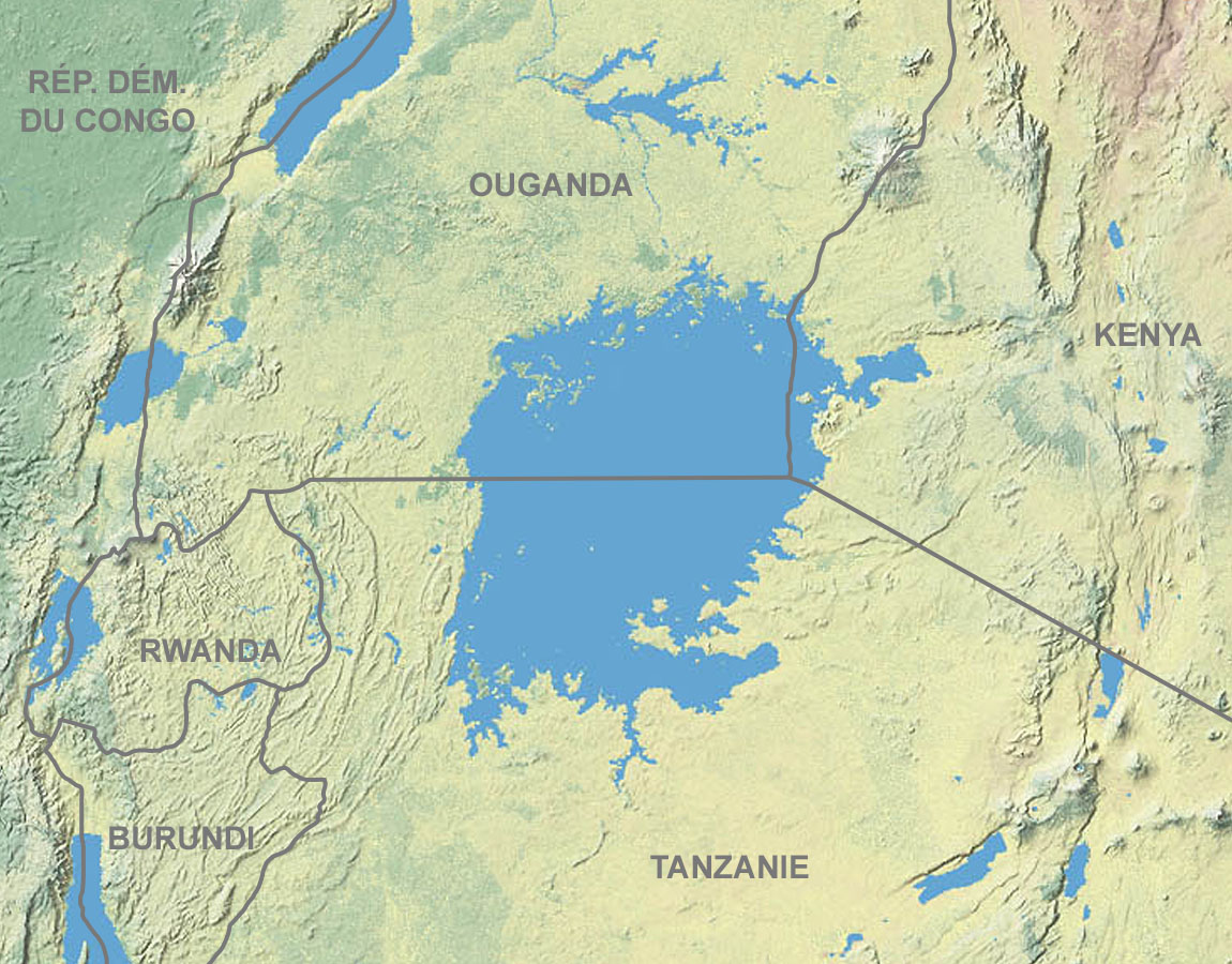
██ Forest
██ Savannah
██ Herbaceous
██ Desert
██ Highland
| Description |
Map in French showing the vegetation of lake Victoria's area |
|---|---|
| Source |
Map from Shadedrelief.com (cropped and modified) |
| Date |
of the upload : December 2006 |
| Author |
Tom Patterson, US National Park Service |
| Permission (Reusing this image) |
Public domain (terms of use) |
| Other versions | Blank : Image:Lake_Victoria_vegetation_map-blank.jpg |
██ Forêt
██ Savane
██ Plantes herbacées
██ Désert
██ Montagne
- Sujet : Carte en français montrant la végétation de la région du lac Victoria ;
- Source : Carte de Shadedrelief.com (recadrée et modifiée) ;
- Auteur : Tom Patterson, US National Park Service ;
- Date du chargement : Décembre 2006.
- Autre version : vierge : Image:Lake_Victoria_vegetation_map-blank.jpg
[edit] Licensing
| This work is in the public domain in the United States because it is a work of the United States Federal Government under the terms of Title 17, Chapter 1, Section 105 of the US Code. See Copyright.
Note: This only applies to works of the Federal Government and not to the work of any individual U.S. state, territory, commonwealth, county, municipality, or any other subdivision. العربية | Български | Česky | Deutsch | English | Español | Français | Magyar | Italiano | 日本語 | 한국어 | Polski | Português | 中文(繁體) | 中文(简体) | +/- |
 |
| This work was previously under Public Domain, or a Free License. It has been digitally enhanced and/or modified. This derivative work has been (or is hereby) released into the public domain by its author, Sting at the French Wikipedia project. This applies worldwide. In some countries this is not legally possible; if so: |
Historique du fichier
Cliquer sur une date et une heure pour voir le fichier tel qu’il était à ce moment-là
| Date et heure | Dimensions | Utilisateur | Commentaire | |
|---|---|---|---|---|
| actuel | 14 décembre 2006 à 16:47 | 1 150×900 (285 Kio) | Sting | ({{Legend|#9ABD9D|Forest}} {{Legend|#C3D3AE|Savannah}} {{Legend|#EAEDB8|Herbaceous}} {{Legend|#E6CDB7|Desert}} {{Legend|#F1F3E6|Highland}} {{Information| |Description=Map in French showing the vegetation of lake Victoria's area |Source=[http://www.carto.n) |
Pages contenant l’image
Aucune page ne contient cette image.
Métadonnées
Ce fichier contient des informations supplémentaires probablement ajoutées par l’appareil photo numérique ou le numériseur qui l’a acquis. Si le fichier a été modifié depuis son état original, certains détails peuvent ne pas refléter entièrement l’image modifiée.
| Orientation | Normale |
|---|---|
| Résolution horizontale | 72 dpi |
| Résolution verticale | 72 dpi |
| Logiciel utilisé | Adobe Photoshop 7.0 |
| Date de modification | 14 décembre 2006 à 12:37 |
| Espace colorimétrique | 65535 |

