Image:India Bangladesh border US Army Map Service.jpg
Un article de Wikipédia, l'encyclopédie libre.

Taille de cet aperçu : 517 × 599 pixels
Image en plus haute résolution (680 × 788 pixels, taille du fichier : 288 Kio, type MIME : image/jpeg)
| | Ce fichier provient de Wikimedia Commons?. Les informations le concernant sont affichées ci-dessous (procédure). |
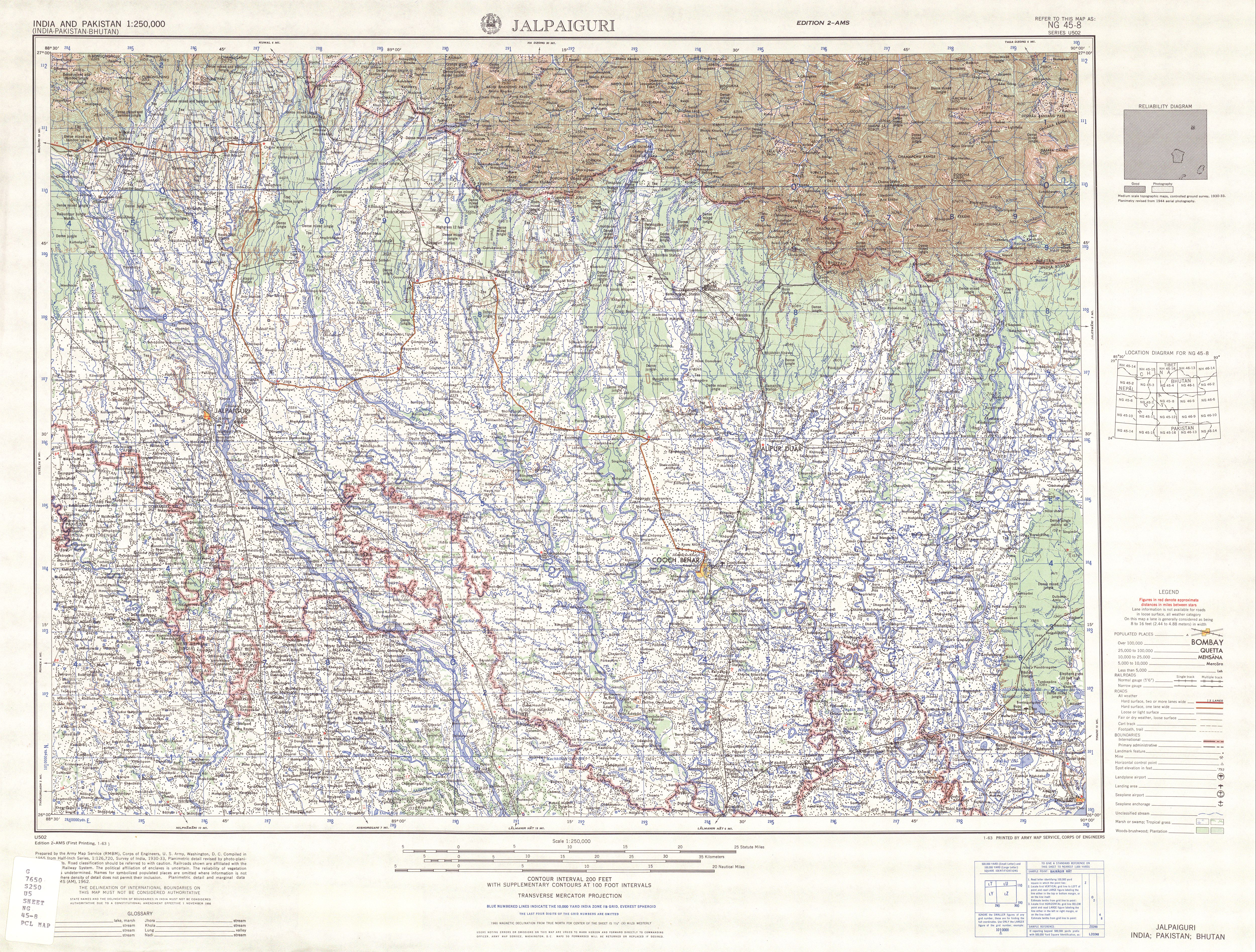
Map of the India-Bangladesh border, US army map service, 1960s. Shows some of the enclaves on the border, but is simplified due to the tiny size of many of them. Located in area near 26°15′43″N, 88°45′6″E There are many smaller enclaves in this area, see external link for a more detailed map. Note: Bangladesh is shown as 'East Pakistan'.
Note: This is not a copyright tag! Many images that use this tag are likely to be in the public domain, but many images, like for example images from WWII taken by members of the axis powers are not. Images must contain a valid copyright tag in addition to this one! For example:
or any other appropriate license tag. |
|
| This image is a copy of txu-oclc-6614190-ng45-8.jpg, a map from the map collection of the Perry-Castañeda Library (PCL) of the University of Texas at Austin. According to the FAQs it might be in the public domain, but please provide additional proof for that. | |
Historique du fichier
Cliquer sur une date et une heure pour voir le fichier tel qu’il était à ce moment-là
| Date et heure | Dimensions | Utilisateur | Commentaire | |
|---|---|---|---|---|
| actuel | 14 mai 2007 à 12:31 | 680×788 (288 Kio) | Roke | (Map of the India-Bangladesh border, US army map service, 1960s. Shows some of the enclaves on the border, but is simplified. {{PD-PCL|txu-oclc-6614190-ng45-8.jpg|/ams/india/}} Category:Maps of India Category:Maps of Bangladesh) |
Pages contenant l’image
La page ci-dessous contient cette image :
Métadonnées
Ce fichier contient des informations supplémentaires probablement ajoutées par l’appareil photo numérique ou le numériseur qui l’a acquis. Si le fichier a été modifié depuis son état original, certains détails peuvent ne pas refléter entièrement l’image modifiée.
| Orientation | Normale |
|---|---|
| Résolution horizontale | 72 dpi |
| Résolution verticale | 72 dpi |
| Logiciel utilisé | Adobe Photoshop CS2 Windows |
| Date de modification | 9 mai 2007 à 23:20 |
| Espace colorimétrique | 65535 |

