Image:Carte générale des environs de la Saline de Chaux.jpg
Un article de Wikipédia, l'encyclopédie libre.
Taille de cet aperçu : 767 × 600 pixels
Image en plus haute résolution (3 123 × 2 441 pixels, taille du fichier : 3,44 Mio, type MIME : image/jpeg)
| | Ce fichier provient de Wikimedia Commons?. Les informations le concernant sont affichées ci-dessous (procédure). |
[edit] Description
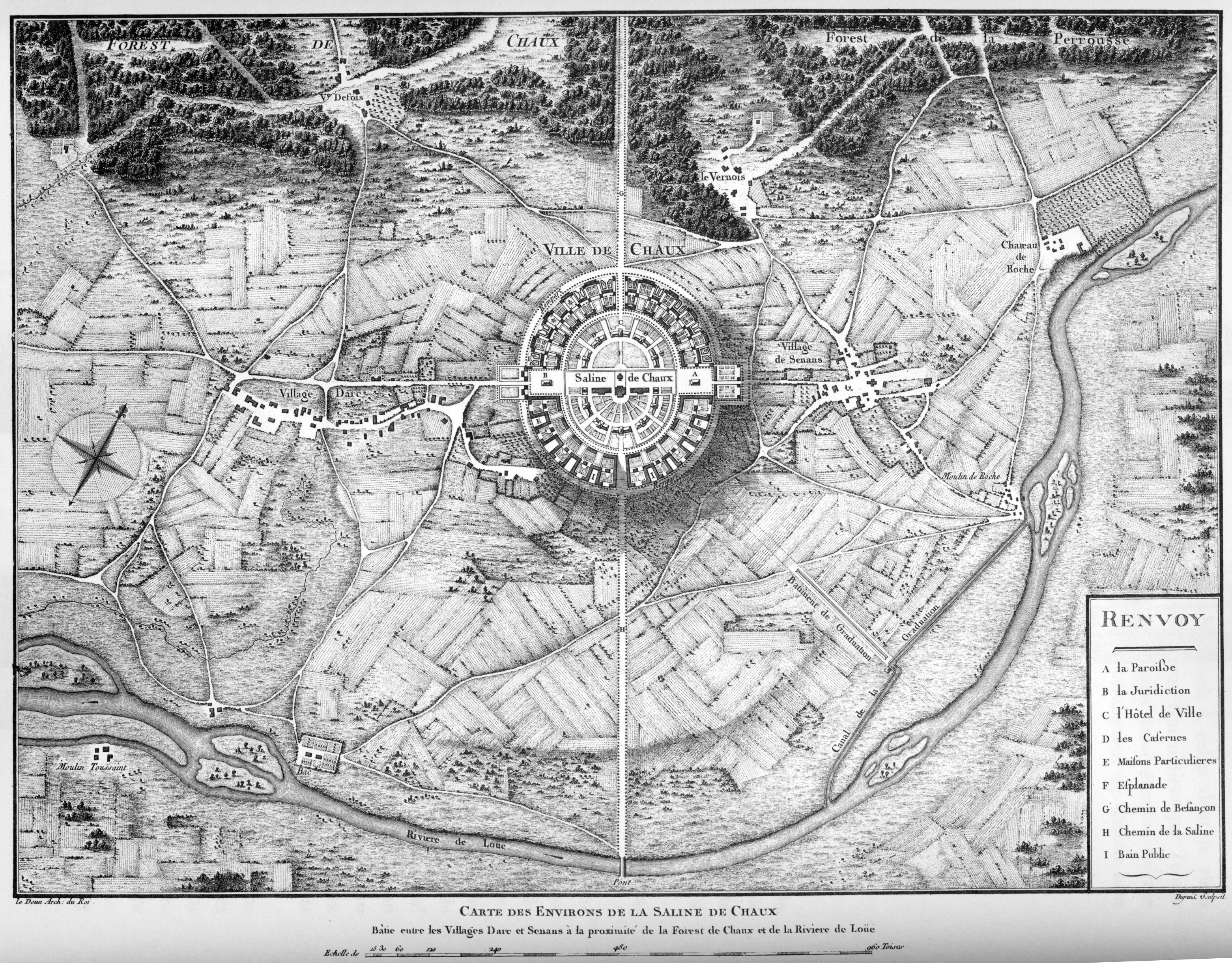
Carte générale des environs de la Saline de Chaux
Planche 14 de « L'architecture considérée sous le rapport de l'art, des moeurs et de la législation », Paris, 1804
[edit] Licensing
| This image (or other media file) is in the public domain because its copyright has expired. This applies to the United States, Canada, the European Union and those countries with a copyright term of life of the author plus 70 years.
العربية | Asturianu | Български | Català | Česky | Dansk | Deutsch | English | Ελληνικά | Esperanto | Español | Euskara | فارسی | Français | Gaeilge | Galego | עברית | हिन्दी | Bahasa Indonesia | Italiano | 日本語 | 한국어 | Kurdî / كوردی | Lietuvių | Magyar | Nederlands | Norsk (nynorsk) | Македонски | Bahasa Melayu | Polski | Português | Română | Русский | Slovenčina | Slovenščina | Shqip | Suomi | Sámegiella | Türkçe | 中文(简体) | 中文(繁體) | 粵語 | +/- |
Historique du fichier
Cliquer sur une date et une heure pour voir le fichier tel qu’il était à ce moment-là
| Date et heure | Dimensions | Utilisateur | Commentaire | |
|---|---|---|---|---|
| actuel | 18 mai 2007 à 14:50 | 3 123×2 441 (3,44 Mio) | Jean-Christophe BENOIST | (== Description == ''Carte générale des environs de la Saline de Chaux'' Planche 14 de « L'architecture considérée sous le rapport de l'art, des moeurs et de la législation », Paris, 1804 Category:Royal Saltworks at Arc-et-Senans == Licensing ) |
| 29 mai 2006 à 23:10 | 600×481 (113 Kio) | Cyberugo | (''Carte générale des environs de la Saline de Chaux'' Planche 14 de « L'architecture considérée sous le rapport de l'art, des moeurs et de la législation », Paris, 1804 Category:Royal Saltworks at Arc-et-Senans) |
Pages contenant l’image
La page ci-dessous contient cette image :
Métadonnées
Ce fichier contient des informations supplémentaires probablement ajoutées par l’appareil photo numérique ou le numériseur qui l’a acquis. Si le fichier a été modifié depuis son état original, certains détails peuvent ne pas refléter entièrement l’image modifiée.
| Orientation | Normale |
|---|---|
| Résolution horizontale | 300 dpi |
| Résolution verticale | 300 dpi |
| Logiciel utilisé | Adobe Photoshop CS2 Windows |
| Date de modification | 18 mai 2007 à 14:48 |
| Espace colorimétrique | 65535 |

