
Kuva:The Ghan route map.png
Wikipedia
Esikatselun koko: 650×600 px
Korkeatarkkuuksinen versio (1 300×1 200 px, 288 KiB, MIME-tyyppi: image/png)
Tämä kuvatiedosto on Wikimedia Commonsista ja se on Wikimedia-projektien yhteiskäytössä. Kuvan sivulla Commons-wikissä on lisätietoja kuvasta ja sen käyttöoikeustiedot.
[edit] Summary
| Description |
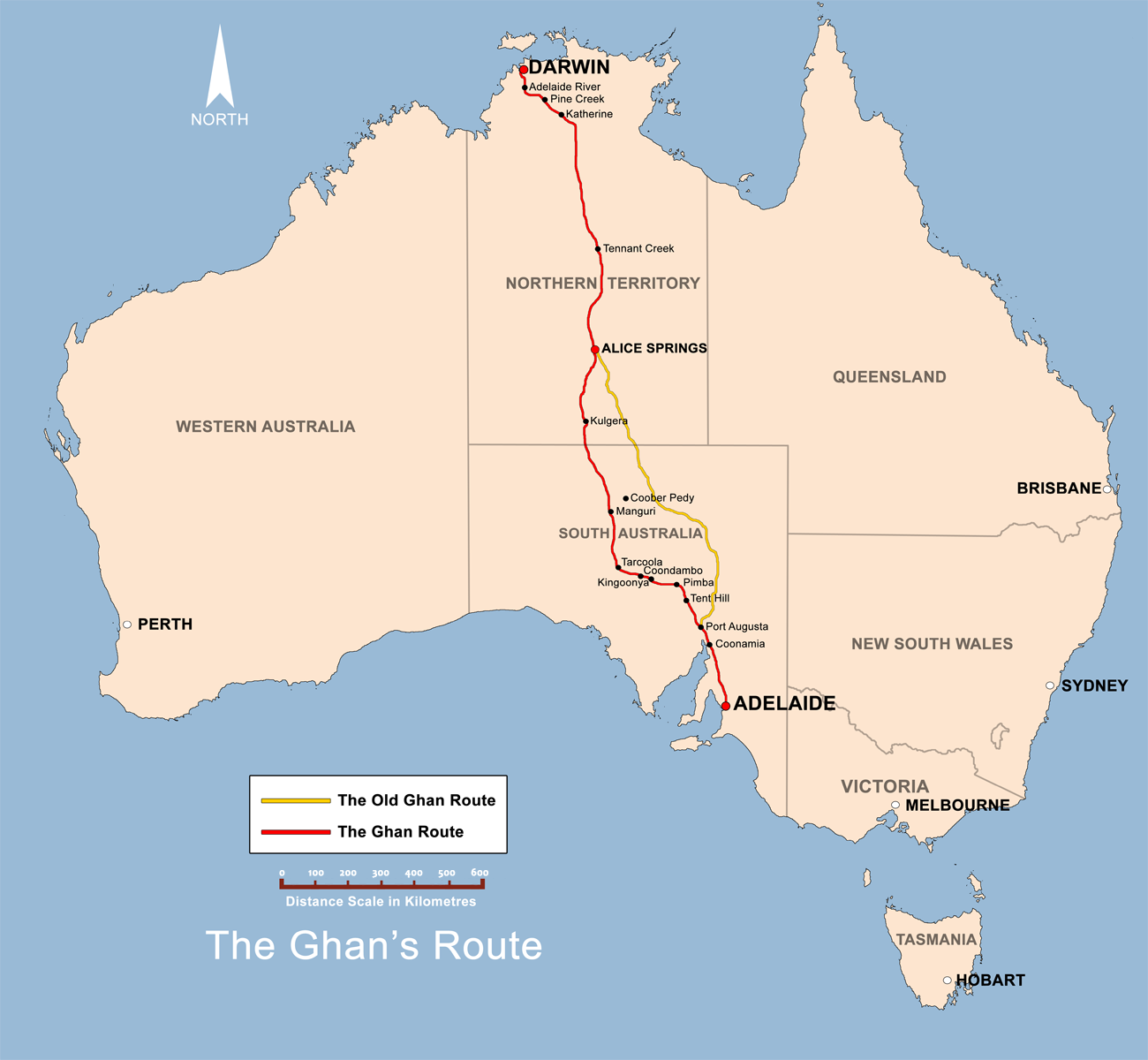
The Ghan route map created by Bidgee based on other Ghan route maps on the internet which are low resolution and are not free to use. |
|---|---|
| Source |
self-made |
| Date |
20th May 2008 |
| Author | |
| Permission (Reusing this image) |
see below |
| Other versions |  |
[edit] Licensing:
|
Tiedoston historia
Päiväystä napsauttamalla näet millainen tiedosto oli sillä ajan hetkellä.
| Päiväys | Koko | Käyttäjä | Kommentti | |
|---|---|---|---|---|
| nykyinen | 13. kesäkuuta 2008 kello 19.22 | 1 300×1 200 (288 KiB) | Bidgee | (Update {{ImageUpload|basic}}) |
| 20. toukokuuta 2008 kello 09.39 | 1 200×1 121 (491 KiB) | Bidgee | (Correcting font sizes) | |
| 20. toukokuuta 2008 kello 09.06 | 1 200×1 121 (486 KiB) | Bidgee | (fix state and territory borders.) | |
| 20. toukokuuta 2008 kello 08.15 | 1 200×1 121 (415 KiB) | Bidgee | (Image fix ) | |
| 20. toukokuuta 2008 kello 07.55 | 1 200×1 121 (415 KiB) | Bidgee | ({{Information |Description=The Ghan route map created by Bidgee based on other Ghan route maps on the internet which are low resolution and are not free to use. |Source=self-made |Date=20th May 2008 |Author= Bidgee |Permiss) |
Viittaukset sivuilta
Seuraavilta sivuilta on linkki tähän tiedostoon:

