تصویر:CongoLualaba watershed topo.png
از ویکیپدیا، دانشنامهٔ آزاد.
اندازهٔ این پیشنمایش: ۷۲۱ × ۵۹۹ پیکسل
تصویر با تفکیکپذیری بالاتر (۱٬۱۵۰ × ۹۵۶ پیکسل، اندازهٔ پرونده: ۷۶۸ کیلوبایت، نوع MIME: image/png)
| | این پرونده در ویکیانبار موجود است. محتویات صفحهٔ توصیف آن در زیر نمایش داده میشود. |
[edit] Summary
| Description |
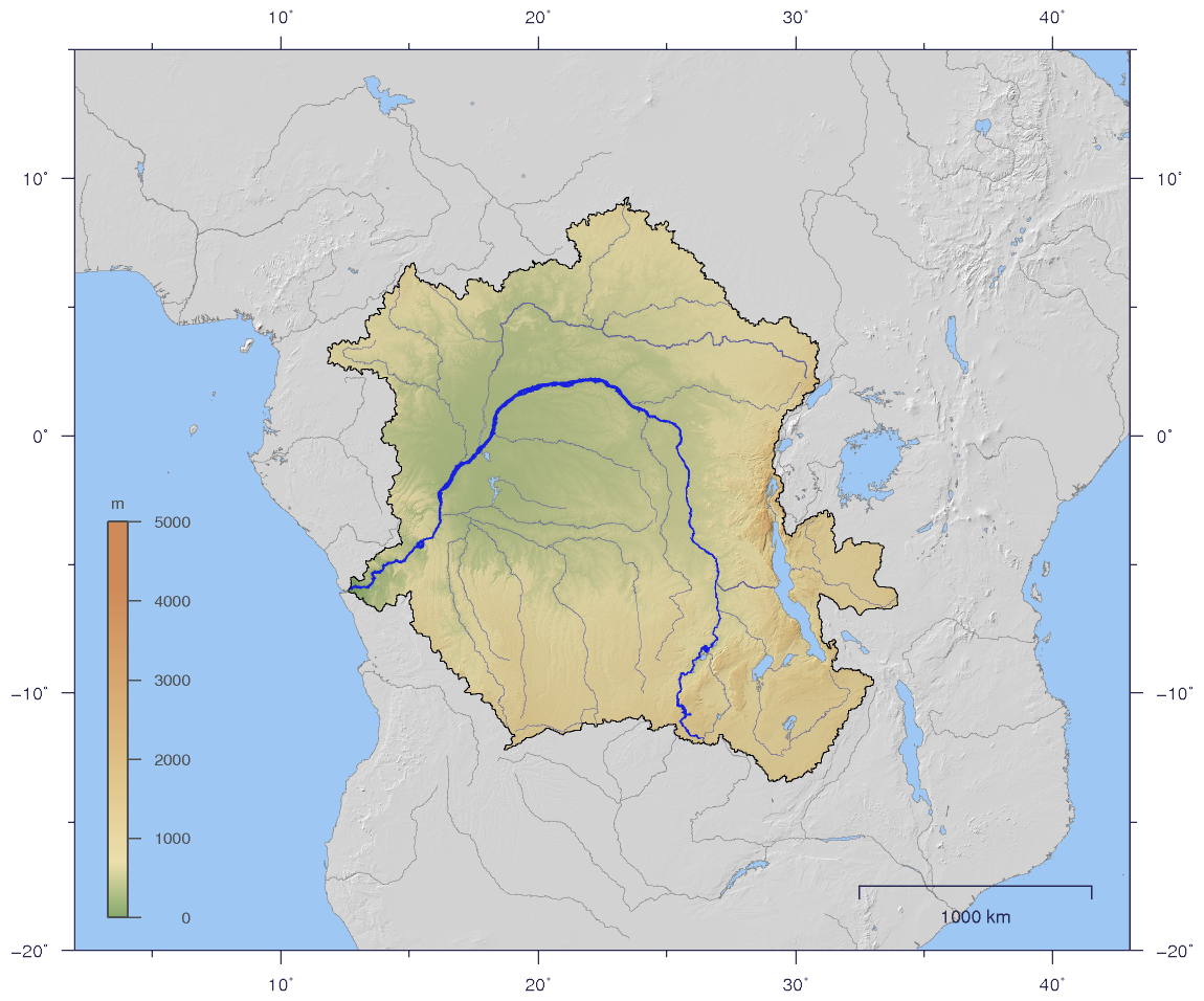
English: Course and Watershed of the Congo and Lualaba River with topography shading.
Deutsch: Verlauf und Einzugsgebiet von Kongo und Lualaba mit Reliefschattierung.
|
||
|---|---|---|---|
| Source |
The map has been created with the Generic Mapping Tools: http://gmt.soest.hawaii.edu/ using additional public comain data from the VMAP0 data set. |
||
| Date |
2007-01-02 |
||
| Author | |||
| Permission (Reusing this image) |
|
||
| Other versions | Image:CongoLualaba_watershed_plain.png |
[edit] Licensing
|
تاریخچه پرونده
روی تاریخها کلیک کنید تا نسخهٔ مربوط را ببینید.
| تاریخ | ابعاد | کاربر | توضیح | |
|---|---|---|---|---|
| نسخهٔ فعلی | ۲ ژانویهٔ ۲۰۰۷، ساعت ۱۹:۵۹ | ۱٬۱۵۰ در ۹۵۶ (۷۶۸ کیلوبایت) | Imagico | ({{Information |Description= {{en|Course and Watershed of the Congo and Lualaba River with topography shading.}} {{de|Verlauf und Einzugsgebiet von Kongo und Lualaba mit Reliefschattierung.}} |Source=The map has been created with the [[:en:Generic Mapping ) |
پیوندهای تصویر
صفحههای زیر به این تصویر پیوند دارند:

