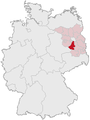
Imagen:Lage des Landkreises Teltow-Flaeming in Deutschland.png
De Wikipedia, la enciclopedia libre
No se dispone de una resolución más alta.
Lage_des_Landkreises_Teltow-Flaeming_in_Deutschland.png (176 × 234 píxeles; tamaño de archivo: 5 KB; tipo MIME: image/png)
| | Éste es un fichero de Wikimedia Commons, un depósito de contenido libre hospedado por la Fundación Wikimedia. Más abajo se reproduce su página de descripción con la información sobre su origen y licencia. |
[edit] Summary
Karte erstellt auf der Grundlage der opengeodb.de-Umrisse.
Moved from de.wikipedia.org, first upload by de:Benutzer:Geograv.
[edit] License
 |
Permission is granted to copy, distribute and/or modify this document under the terms of the GNU Free Documentation License, Version 1.2 or any later version published by the Free Software Foundation; with no Invariant Sections, no Front-Cover Texts, and no Back-Cover Texts. A copy of the license is included in the section entitled "Text of the GNU Free Documentation License".
This image was generated with http://opengeodb.hoppe-media.com/. Permission to use it under GFDL was given by its author Akl. |
Historial del archivo
Haga clic sobre una fecha/hora para ver el archivo a esa fecha.
| Fecha/Hora | Dimesiones | Usuario | Comentario | |
|---|---|---|---|---|
| act | 00:19 18 jun 2006 | 176×234 (5 KB) | Geograv | (== Summary == Karte erstellt auf der Grundlage der opengeodb.de-Umrisse. Moved from de.wikipedia.org, first upload by de:Benutzer:Geograv. == License == {{GFDL-OpenGeoDB}} Category:Maps of Brandenburg ) |
Enlaces a la imagen
Las siguientes páginas enlazan a esta imagen:

