Imagen:Indonesia provinces english.png
De Wikipedia, la enciclopedia libre
Dimensiones de esta vista previa: 800 × 315 píxeles
Ver la imagen en su resolución original (1.500 × 590 píxeles; tamaño de archivo: 77 KB; tipo MIME: image/png)
| | Éste es un fichero de Wikimedia Commons, un depósito de contenido libre hospedado por la Fundación Wikimedia. Más abajo se reproduce su página de descripción con la información sobre su origen y licencia. |
 |
This map image should be recreated using vector graphics as an SVG file. This has several advantages; see Commons:Media for cleanup for more information. If an SVG form of this image is already available, please upload it. After uploading an SVG, replace this template with template {{Vector version available|new image name.svg}} in this image. |
|
العربية | Български | Català | Česky | Dansk | Deutsch | English | Esperanto | Español | Français | 한국어 | Italiano | Magyar | Lietuvių | Nederlands | 日本語 | Polski | Português | Română | Русский | Suomi | Svenska | Türkçe | Українська | Tiếng Việt | मराठी | 中文(繁體) | 中文(简体) | +/- |
|
[edit] Summary
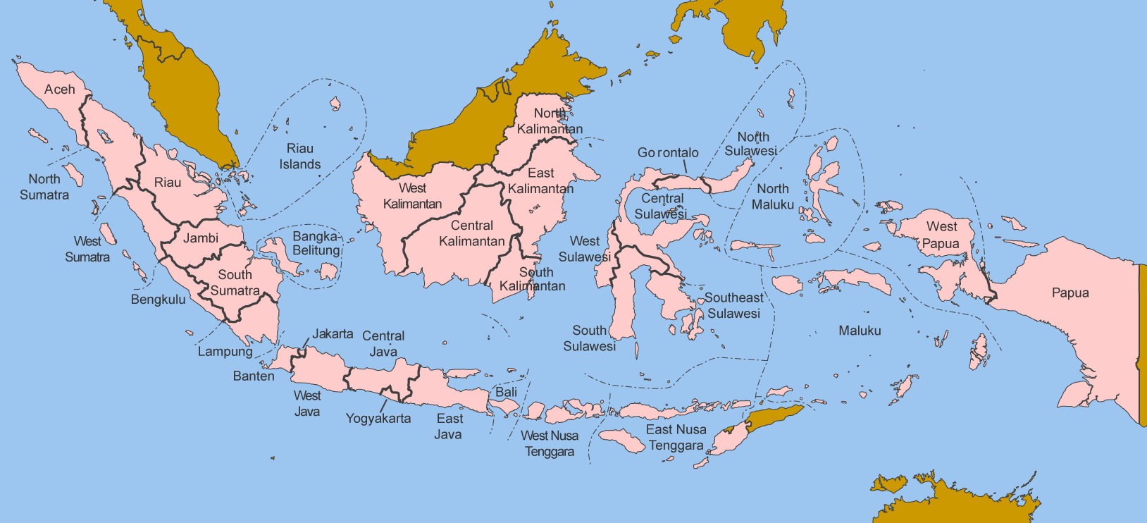
Map of the provinces of Indonesia in English.
Made by User:Golbez based on a PD CIA map, using other sources to guesstimate the extent of West Irian Jaya and West Sulawesi.
[edit] Licensing
|

Historial del archivo
Haga clic sobre una fecha/hora para ver el archivo a esa fecha.
| Fecha/Hora | Dimesiones | Usuario | Comentario | |
|---|---|---|---|---|
| act | 07:54 8 ene 2006 | 1.500×590 (77 KB) | Golbez | (Map of the provinces of Indonesian in English. Made by User:Golbez based on a PD CIA map, using other sources to guesstimate the extent of West Irian Jaya and West Sulawesi. Category:Maps of Indonesia) |
Enlaces a la imagen
Las siguientes páginas enlazan a esta imagen:

