
Image:SiegeAlesia.png
From Wikipedia, the free encyclopedia
Size of this preview: 693 × 599 pixels
Full resolution (977 × 845 pixels, file size: 46 KB, MIME type: image/png)
| | This is a file from the Wikimedia Commons. The description on its description page there is shown below.
|
[edit] Summary
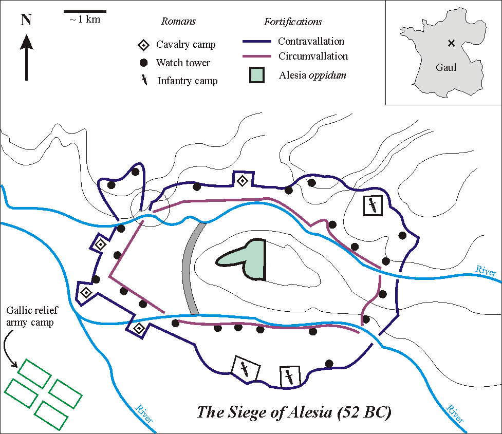
Español: Las fortificaciones construidas por César en Alesia de acuerdo a la hipótesis de localización en Alise-Sainte-Reine
En el mapa de la esquina la cruz muestra la localización de Alesia en la Galia (hoy Francia). En el esquema, el círculo muestra el punto débil en la circunvalación
En el mapa de la esquina la cruz muestra la localización de Alesia en la Galia (hoy Francia). En el esquema, el círculo muestra el punto débil en la circunvalación
Sketch of the Battle of Alesia, drawn by Muriel Gottrop in December 2004. Inbox: cross shows location of Alesia in Gaul (modern France). The open circle shows the weakness in the contravallation line
| This file is licensed under Creative Commons Attribution ShareAlike 1.0 License |
File history
Click on a date/time to view the file as it appeared at that time.
| Date/Time | Dimensions | User | Comment | |
|---|---|---|---|---|
| current | 12:03, 2 December 2004 | 977×845 (46 KB) | Muriel Gottrop | (Sketch of the Battle of Alesia, drawn by Muriel Gottrop in December 2004. {{GFDL}}) |
File links
The following pages on the English Wikipedia link to this file (pages on other projects are not listed):

