
Image:Palestine election map.PNG
From Wikipedia, the free encyclopedia
Size of this preview: 437 × 600 pixels
Full resolution (1,115 × 1,530 pixels, file size: 106 KB, MIME type: image/png)
| | This is a file from the Wikimedia Commons. The description on its description page there is shown below.
|
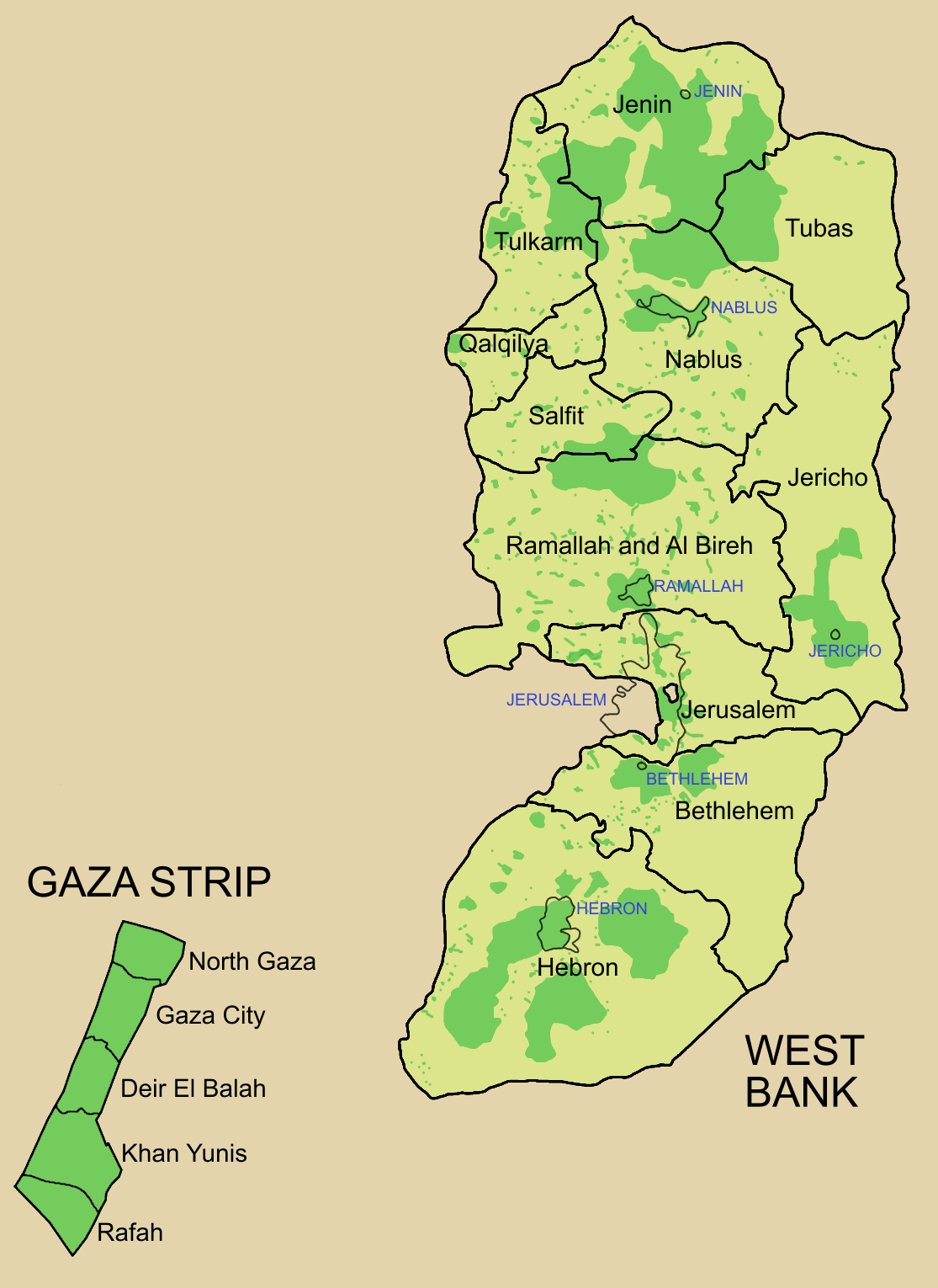
Note: author of this map is: User:Astrokey44.
[edit] Summary
Palestine divided into electoral districts (as of 2006), marked with thick black borders. (thinner borders show boundaries of cities, with city names marked in blue). Green shows areas of formal Palestinian authority. Map made using information from other maps such as this. There is a map of the West Bank and Gaza governates from 1995 here
 |
This map image should be recreated using vector graphics as an SVG file. This has several advantages; see Commons:Media for cleanup for more information. If an SVG form of this image is already available, please upload it. After uploading an SVG, replace this template with template {{Vector version available|new image name.svg}} in this image. |
|
العربية | Български | Català | Česky | Dansk | Deutsch | English | Esperanto | Español | Français | 한국어 | Italiano | Magyar | Lietuvių | Nederlands | 日本語 | Polski | Português | Română | Русский | Suomi | Svenska | Türkçe | Українська | Tiếng Việt | 中文(繁體) | 中文(简体) | +/- |
|
[edit] Licensing

File history
Click on a date/time to view the file as it appeared at that time.
| Date/Time | Dimensions | User | Comment | |
|---|---|---|---|---|
| current | 09:57, 5 July 2006 | 1,115×1,530 (106 KB) | Roke | (request to make all of gaza strip dark green ) |
| 05:38, 28 January 2006 | 1,115×1,530 (104 KB) | Roke | (Palestine divided into electoral districts, marked with black borders. Green shows areas of formal Palestinian authority. I made the map, using information from other maps such as [http://www.nytimes.com/imagepages/2006/01/25/international/20060125_palest) |
File links
The following pages on the English Wikipedia link to this file (pages on other projects are not listed):

