
Image:Outre-mer en.png
From Wikipedia, the free encyclopedia
Size of this preview: 800 × 415 pixels
Full resolution (1,432 × 742 pixels, file size: 58 KB, MIME type: image/png)
| | This is a file from the Wikimedia Commons. The description on its description page there is shown below.
|
|
|
The neutrality of this article is disputed. Please see the discussion on the talk page.(December 2007) Please do not remove this message until the dispute is resolved. |
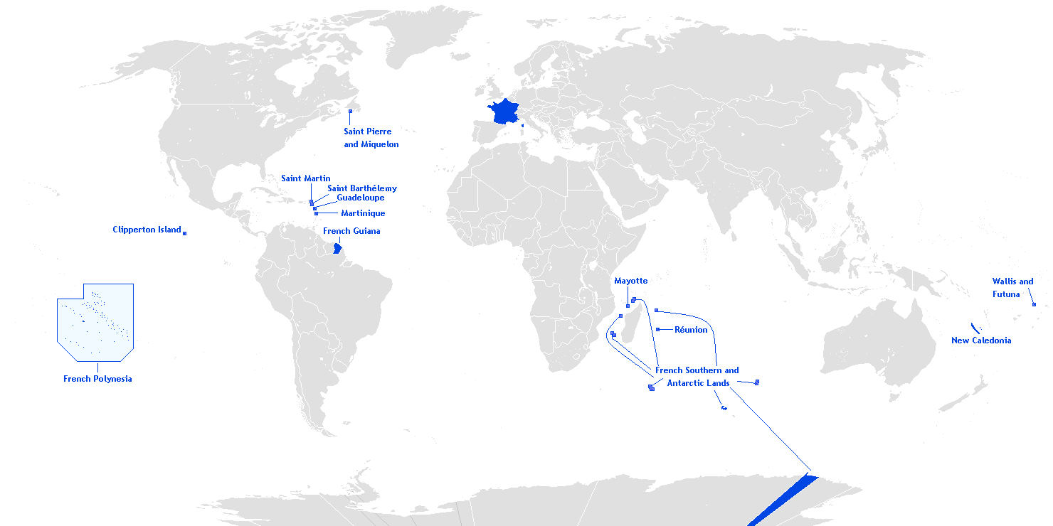
English: This is a translation from esperanto (by Hoshie) into english of User:Manchot sanguinaire's map of French Overseas départements, regions, collectivités, and territories, which is at Image:Outre-mer eo.png. The translations of the names into english are the names used in the CIA World Factbook. I also also added the five Îles Éparses that surround Madagascar. The source for their placement on the map is the CIA Factbook map of the area, which is here on Commons at Image:Iles Eparses-CIA WFB Map.png. The placement of Adélie Land is based upon Image:Antarctica territorial claims.png by User:Astrokey44. Since the original map is GFDL, this one is too.
[edit] License

File history
Click on a date/time to view the file as it appeared at that time.
| Date/Time | Dimensions | User | Comment | |
|---|---|---|---|---|
| current | 03:12, 17 December 2007 | 1,432×742 (58 KB) | Rosss | (More accurate shape for French Polynesia) |
| 02:44, 22 April 2007 | 1,432×742 (39 KB) | Kelvinc | (fixed shading of antarctica east of adelie land ) | |
| 09:59, 17 April 2007 | 1,432×742 (26 KB) | Tene | (Optimised (0)) | |
| 14:14, 5 March 2007 | 1,432×742 (60 KB) | Hoshie | (added Antarctica itself to the image and marked the French claim. The position of St.-Barth and St.-Martin has been fixed) | |
| 18:26, 4 March 2007 | 1,357×628 (53 KB) | Hoshie | (removed labels for the Iles Eparses, since they are a part of the TAAF; see http://www.taaf.fr/rubriques/iles/iles_introduction.htm) | |
| 07:11, 2 March 2007 | 1,357×628 (54 KB) | Hoshie | (fixed map to include St.-Martin and St.-Barth.) | |
| 23:52, 27 February 2007 | 1,357×628 (55 KB) | Rosss | (Added Saint-Barthélemy and Saint-Martin.) | |
| 04:10, 1 February 2007 | 1,357×628 (54 KB) | Hoshie | (forgot Newfoundland in the new grey.) | |
| 04:01, 1 February 2007 | 1,357×628 (54 KB) | Hoshie | (added France's Antarctic claim and changed the gray color of the land.) | |
| 09:44, 31 January 2007 | 1,357×628 (36 KB) | Hoshie | (This is a translation from Esperanto (by ~~~) of User:Manchot sanguinaire's map of French Overseas département, regions, collectivités, and territories, which is at Image:Outre-mer eo.png. Besides the translations, ~~~ has added the five Îles ) |
File links
The following pages on the English Wikipedia link to this file (pages on other projects are not listed):

