
Image:Karte Oberursel in Deutschland.png
From Wikipedia, the free encyclopedia
No higher resolution available.
Karte_Oberursel_in_Deutschland.png (188 × 235 pixels, file size: 5 KB, MIME type: image/png)
| | This is a file from the Wikimedia Commons. The description on its description page there is shown below.
|
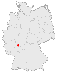
Lage von Oberursel auf Deutschlandkarte
Bild-GFDL-OpenGeoDB
from de:Bild:Karte Oberursel in Deutschland.png. Uploaded there by Akl.
 |
Permission is granted to copy, distribute and/or modify this document under the terms of the GNU Free Documentation License, Version 1.2 or any later version published by the Free Software Foundation; with no Invariant Sections, no Front-Cover Texts, and no Back-Cover Texts. A copy of the license is included in the section entitled "Text of the GNU Free Documentation License".
This image was generated with http://opengeodb.hoppe-media.com/. Permission to use it under GFDL was given by its author Akl. |
File history
Click on a date/time to view the file as it appeared at that time.
| Date/Time | Dimensions | User | Comment | |
|---|---|---|---|---|
| current | 11:28, 24 July 2005 | 188×235 (5 KB) | Angela | (Lage von Oberursel auf Deutschlandkarte <pre>{{Bild-GFDL-OpenGeoDB}}</pre> en:Image:Map oberursel.jpg from w:de:Bild:Karte Oberursel in Deutschland.png. Uploaded there by Akl. {{GFDL}}) |
File links
The following pages on the English Wikipedia link to this file (pages on other projects are not listed):

