
Image:Carolingian Empire map 1895.jpg
From Wikipedia, the free encyclopedia
Size of this preview: 800 × 569 pixels
Full resolution (5,697 × 4,050 pixels, file size: 7.84 MB, MIME type: image/jpeg)
| | This is a file from the Wikimedia Commons. The description on its description page there is shown below.
|
 |
This map has been uploaded by Electionworld from en.wikipedia.org to enable the |
| This image (or other media file) is in the public domain because its copyright has expired. This applies to the United States, Canada, the European Union and those countries with a copyright term of life of the author plus 70 years.
العربية | Asturianu | Български | Català | Česky | Dansk | Deutsch | English | Ελληνικά | Esperanto | Español | Euskara | فارسی | Français | Gaeilge | Galego | עברית | हिन्दी | Bahasa Indonesia | Italiano | 日本語 | 한국어 | Kurdî / كوردی | Lietuvių | Magyar | Nederlands | Norsk (nynorsk) | Bahasa Melayu | Polski | Português | Română | Русский | Slovenčina | Slovenščina | Shqip | Suomi | Sámegiella | Türkçe | 中文(简体) | 中文(繁體) | 粵語 | +/- |
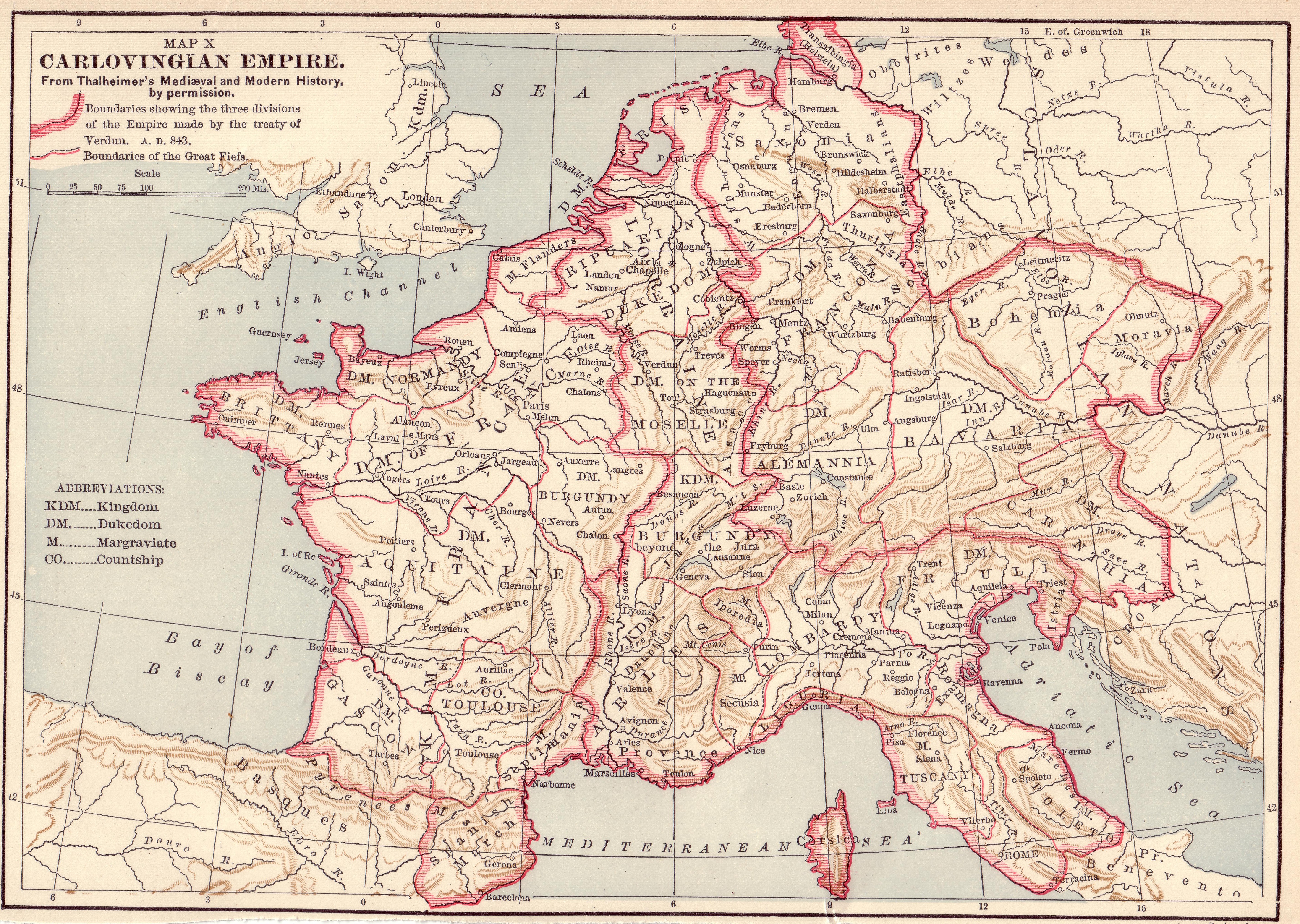
Source: Scanned by Stbalbach from Ridpath's Universal History, Copyright 1895, Section XII, Page 512.
File history
Click on a date/time to view the file as it appeared at that time.
| Date/Time | Dimensions | User | Comment | |
|---|---|---|---|---|
| current | 19:52, 20 December 2006 | 5,697×4,050 (7.84 MB) | Electionworld | ({{ew|en|}} {{PD-old}} Source: Scanned by Stbalbach from {{link|Ridpath's Universal History}}, Copyright 1895, Section XII, Page 512. ) |

