
Image:California map showing Alameda County.png
From Wikipedia, the free encyclopedia
No higher resolution available.
California_map_showing_Alameda_County.png (200 × 231 pixels, file size: 22 KB, MIME type: image/png)
| | This is a file from the Wikimedia Commons. The description on its description page there is shown below.
|
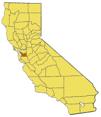
Map of Alameda county in California. From en:

File history
Click on a date/time to view the file as it appeared at that time.
| Date/Time | Dimensions | User | Comment | |
|---|---|---|---|---|
| current | 16:51, 1 July 2005 | 200×231 (22 KB) | Pyramide | (Map of Alameda county in California. From en: {{GFDL}} Category:Maps of counties in California) |
File links
The following pages on the English Wikipedia link to this file (pages on other projects are not listed):
- Fairview, California
- Jack London Square
- Claremont Canyon Regional Preserve
- East Bay Municipal Utility District
- Tri-Valley
- Iron Horse Regional Trail
- Coyote Hills Regional Park
- Niles Canyon
- Monument Peak
- Mount Allison
- Oakland Museum of California
- Mount Eden, California
- William Joseph McInnes Botanic Garden and Campus Arboretum
- Haas Pavilion
- Nolo.com
- Coyote Creek (Santa Clara County)
- South Bay Aqueduct
- Golden Gate, Oakland, California
- Elmhurst, Oakland, California
- Drawbridge, California
- Grass Valley, Oakland, California
- Seminary, Oakland, California
- Fruitvale, Oakland, California
- Vallejo Flour Mill
- San Leandro Oyster Beds
- Peralta Home
- First Unitarian Church of Oakland
- Berkeley City Club
- Croll Building
- Anthony Chabot Regional Park
- Sunol Valley
- Berkeley Pier
- Ridgemont, Oakland, California
- Temescal Regional Park
- Trestle Glen, Oakland, California
- Dimond District, Oakland, California
- Old Oakland
- Indian Rock Park
- Grizzly Peak (Berkeley Hills)
- Emeryville Crescent State Marine Reserve
- Westbrae, Berkeley, California
- Glenview, Oakland, California
- Redwood Heights, Oakland, California
- Oakmore, Oakland, California
- Bay Farm Island, Alameda, California
- Alameda Creek
- Oakland Estuary
- Oakland hills
- Network of Bay Area Worker Cooperatives
- UC Village
- Alameda Point, Alameda, California
- The Chandler Building
- Dogtown, Oakland, California
- Lake Chabot
- Template:AlamedaCountyCA-geo-stub
- Bethany Reservoir
- South Berkeley, Berkeley, California
- San Leandro Creek
- Arroyo Seco (Alameda County)
- Arroyo del Valle
- Middle Harbor Shoreline Park
- Mocho Subbasin
- Arroyo Mocho
- Arroyo de la Laguna
- Downtown Oakland
- Bernal Subbasin
- South Hall (UC Berkeley)
- Damon Marsh
- Joaquin Miller Park
- Brushy Peak Regional Preserve
- Cull Canyon Regional Recreation Area
- Del Valle Regional Park
- Don Castro Regional Recreation Area
- Dry Creek Pioneer Regional Park
- Garin Regional Park
- Hayward Regional Shoreline
- Huckleberry Botanic Regional Preserve
- Lake Chabot Regional Park
- Leona Canyon Regional Open Space Preserve
- Martin Luther King Jr. Shoreline
- Morgan Territory Regional Preserve
- Ohlone Wilderness
- Quarry Lakes Regional Recreation Area
- Ridgelands Regional Park
- Roberts Regional Recreation Area
- Shadow Cliffs Regional Park
- Crown Memorial State Beach
- Millsmont, Oakland, California
- Brookfield Village, Oakland, California
- North Oakland, Oakland, California
- Morcom Rose Garden
- Manasse-Block Tanning Company
- Downtown Hayward
- Russell City, California
- Integrated Support Command Alameda
- Oakland Point, Oakland, California
- Mowry Slough
- Schafer Park, California
- Hacienda Business Park
- Marin Creek
View more links to this file.

