Bild:Palliser's Triangle map.png
aus Wikipedia, der freien Enzyklopädie
Größe der Voransicht: 780 × 600 Pixel
Version in höherer Auflösung (1.000 × 769 Pixel, Dateigröße: 301 KB, MIME-Typ: image/png)
| | Diese Datei wird aus dem zentralen, mehrsprachigen Dateiarchiv Wikimedia Commons eingebunden. Sämtliche Informationen unter dem roten Trennstrich stammen von der dortigen Beschreibungsseite der Datei. | |
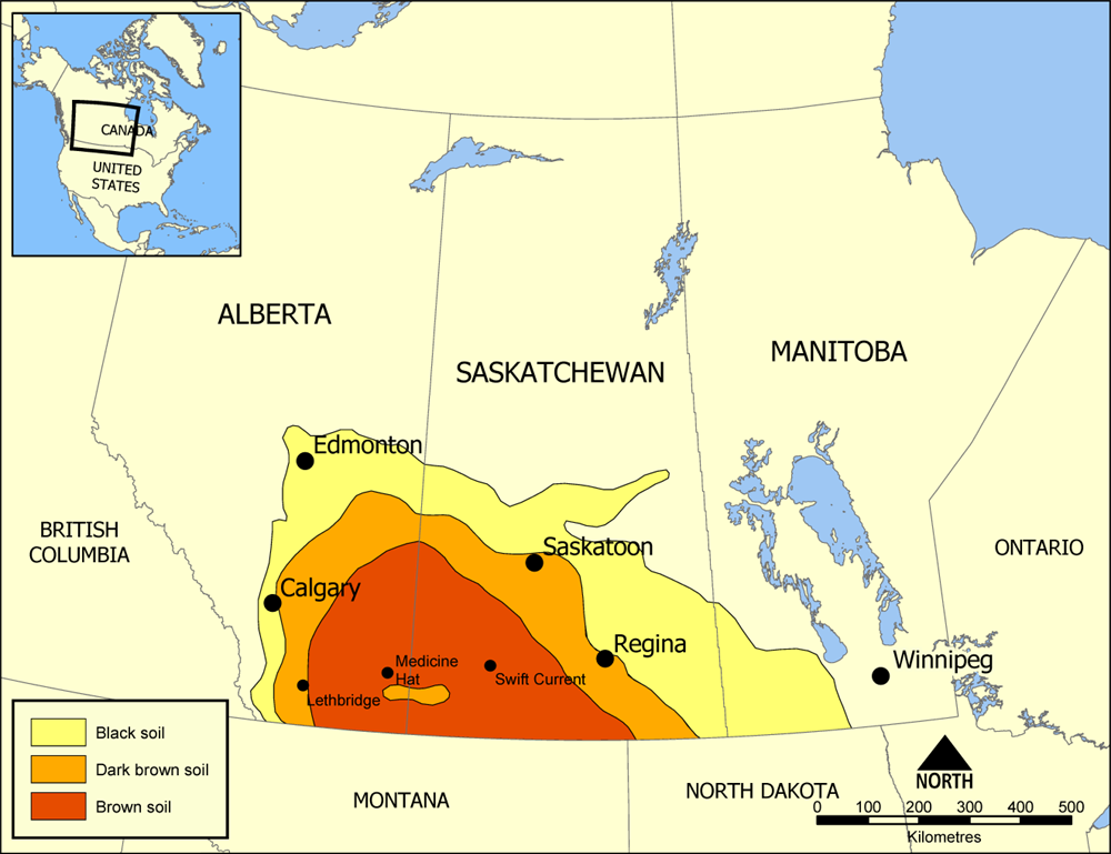
Map showing the extent of Palliser's Triangle in Western Canada. The area covers parts of Alberta, Saskatchewan, and Manitoba and is notable for its lack of trees. The lack of sturdy vegetation devastated the area during the Dust Bowl of the 1930s, but modern irrigation has allowed it to become an important wheat and beef area.
Created by NormanEinstein July 18, 2005.

Dateiversionen
Klicke auf einen Zeitpunkt, um diese Version zu laden.
| Version vom | Maße | Benutzer | Kommentar | |
|---|---|---|---|---|
| aktuell | 17:50, 18. Jul. 2005 | 1.000×769 (301 KB) | NormanEinstein | (Map showing the extent of Palliser's Triangle in Western Canada. The area covers parts of Alberta, Saskatchewan, and Manitoba and is notable for its lack of trees. The lack of sturdy vegetation devastated the area during the Dust Bowl of the 1930s, but mo) |
Verwendung
Die folgende Seite verwendet diese Datei:

