Bild:Cumberlandplateaumap.png
aus Wikipedia, der freien Enzyklopädie
Keine höhere Auflösung vorhanden.
Cumberlandplateaumap.png (600 × 600 Pixel, Dateigröße: 539 KB, MIME-Typ: image/png)
| | Diese Datei wird aus dem zentralen, mehrsprachigen Dateiarchiv Wikimedia Commons eingebunden. Sämtliche Informationen unter dem roten Trennstrich stammen von der dortigen Beschreibungsseite der Datei. | |
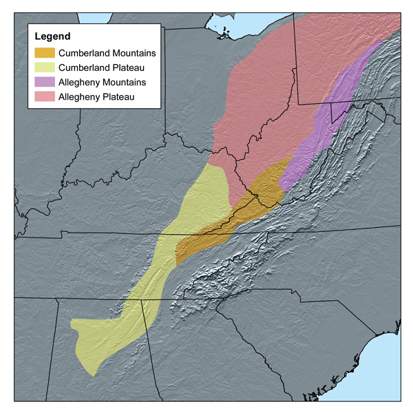
This map shows the subdivisions of the southern Appalachian Plateau as defined by Bailey's ecoregions.[1] I, Karl Musser, created it based on USGS.
|
Dateiversionen
Klicke auf einen Zeitpunkt, um diese Version zu laden.
| Version vom | Maße | Benutzer | Kommentar | |
|---|---|---|---|---|
| aktuell | 16:56, 20. Mär. 2007 | 600×600 (539 KB) | Kmusser | (This map shows the subdivisions of the southern Appalachian Plateau as defined by Bailey's ecoregions.[http://www.fs.fed.us/rm/analytics/publications/ecoregionsindex.html] I, Karl Musser, created it based o) |
Verwendung
Die folgenden 2 Seiten verwenden diese Datei:

