
Kuva:Map swedish lands.png
Wikipedia
Tarkempaa kuvaa ei ole saatavilla.
Map_swedish_lands.png (275×400 px, 13 KiB, MIME-tyyppi: image/png)
Tämä kuvatiedosto on Wikimedia Commonsista ja se on Wikimedia-projektien yhteiskäytössä. Kuvan sivulla Commons-wikissä on lisätietoja kuvasta ja sen käyttöoikeustiedot.
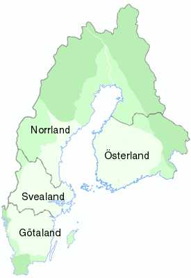
A map of Sweden and Finland, with the ancient region Norrland marked - not to be confused with the current region Norrland. From en:WP Image:Map swedish lands.png, uploaded there by en:User:Mic.
 |
Permission is granted to copy, distribute and/or modify this document under the terms of the GNU Free Documentation License, Version 1.2 or any later version published by the Free Software Foundation; with no Invariant Sections, no Front-Cover Texts, and no Back-Cover Texts. Subject to disclaimers. Asturianu | Български | Català | Deutsch | English | Español | Français | Gaeilge | Italiano | 한국어 | 日本語 | Polski | Português | Română | Türkçe | +/- |
Tiedoston historia
Päiväystä napsauttamalla näet millainen tiedosto oli sillä ajan hetkellä.
| Päiväys | Koko | Käyttäjä | Kommentti | |
|---|---|---|---|---|
| nykyinen | 17. kesäkuuta 2005 kello 21.14 | 275×400 (13 KiB) | Habj | (A map of Sweden and Finland, with the ancient region Norrland marked - not to be confused with the current region Norrland. From en:WP Image:Map swedish lands.png, uploaded there by en:User:Mic. {{GFDL}}) |
Viittaukset sivuilta
Seuraavilta sivuilta on linkki tähän tiedostoon:

