Bild:Canada provinces 1927-1949.png
aus Wikipedia, der freien Enzyklopädie
Größe der Voransicht: 694 × 600 Pixel
Version in höherer Auflösung (1.000 × 864 Pixel, Dateigröße: 47 KB, MIME-Typ: image/png)
| | Diese Datei wird aus dem zentralen, mehrsprachigen Dateiarchiv Wikimedia Commons eingebunden. Sämtliche Informationen unter dem roten Trennstrich stammen von der dortigen Beschreibungsseite der Datei. | |
[edit] Summary
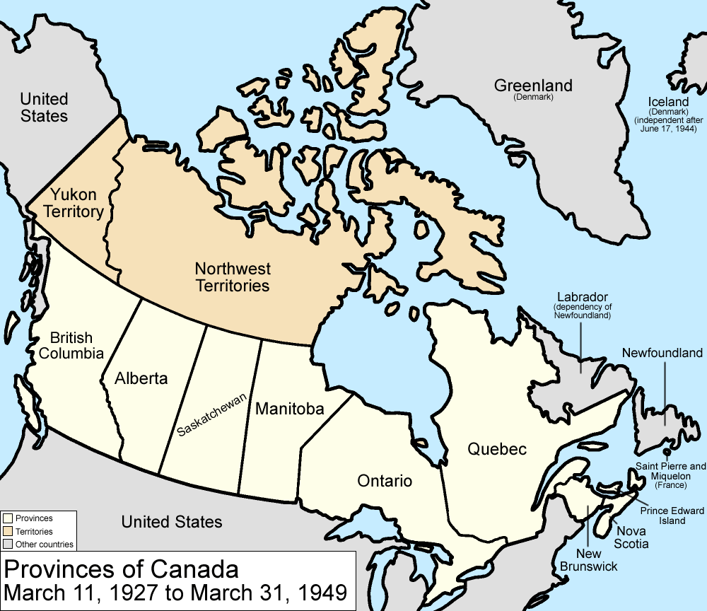
Map of the provinces and territories of Canada as they were between 1927 and 1949. On March 1 1927, a court transferred a disputed portion of Quebec to the Dominion of Newfoundland. On March 31 1949, Newfoundland joined Canada as a province.
Made by User:Golbez.
[edit] Licensing
|

Dateiversionen
Klicke auf einen Zeitpunkt, um diese Version zu laden.
| Version vom | Maße | Benutzer | Kommentar | |
|---|---|---|---|---|
| aktuell | 11:59, 7. Aug. 2006 | 1.000×864 (47 KB) | Golbez | (with legend) |
| 04:25, 18. Feb. 2006 | 1.000×864 (46 KB) | Golbez | (Better version) | |
| 01:49, 14. Feb. 2006 | 1.000×864 (41 KB) | Golbez | (better colors) | |
| 08:35, 13. Feb. 2006 | 1.000×864 (41 KB) | Golbez | (Map of the provinces and territories of Canada as they were between 1927 and 1949. On March 1 1927, a court transferred a disputed portion of Quebec to the Dominion of Newfoundland. On March 31 1949, Newfoundland joined Canada as a province. Made by [[U) |
Verwendung
Die folgenden 3 Seiten verwenden diese Datei:

