Bild:Canada provinces 1895-1898.png
aus Wikipedia, der freien Enzyklopädie
Größe der Voransicht: 694 × 600 Pixel
Version in höherer Auflösung (1.000 × 864 Pixel, Dateigröße: 46 KB, MIME-Typ: image/png)
| | Diese Datei wird aus dem zentralen, mehrsprachigen Dateiarchiv Wikimedia Commons eingebunden. Sämtliche Informationen unter dem roten Trennstrich stammen von der dortigen Beschreibungsseite der Datei. | |
[edit] Summary
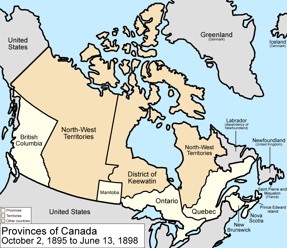
Map of the provinces and territories of Canada as they were from 1895 to 1898. In 1895, the District of Keewatin was enlarged. On June 13 1898, Yukon Territory is formed mostly from the District of Yukon in the North-West Territories, and Quebec is enlarged from land from the North-West Territories.
Made by User:Golbez.
[edit] Licensing
|

Dateiversionen
Klicke auf einen Zeitpunkt, um diese Version zu laden.
| Version vom | Maße | Benutzer | Kommentar | |
|---|---|---|---|---|
| aktuell | 11:59, 7. Aug. 2006 | 1.000×864 (46 KB) | Golbez | (with legend) |
| 09:31, 28. Mär. 2006 | 1.000×864 (45 KB) | Golbez | (fix wrong caption) | |
| 04:24, 18. Feb. 2006 | 1.000×864 (44 KB) | Golbez | (Better version) | |
| 01:49, 14. Feb. 2006 | 1.000×864 (40 KB) | Golbez | (better colors) | |
| 11:28, 13. Feb. 2006 | 1.000×864 (40 KB) | Golbez | (Map of the provinces and territories of Canada as they were from 1895 to 1898. In 1895, the District of Keewatin was enlarged. On June 13 1898, Yukon Territory is formed mostly from the District of Yukon in the North-West Territories, and Quebec is enlarg) |
Verwendung
Die folgende Seite verwendet diese Datei:

