Bild:Canada provinces 1881-1886.png
aus Wikipedia, der freien Enzyklopädie
Größe der Voransicht: 694 × 600 Pixel
Version in höherer Auflösung (1.000 × 864 Pixel, Dateigröße: 47 KB, MIME-Typ: image/png)
| | Diese Datei wird aus dem zentralen, mehrsprachigen Dateiarchiv Wikimedia Commons eingebunden. Sämtliche Informationen unter dem roten Trennstrich stammen von der dortigen Beschreibungsseite der Datei. | |
[edit] Summary
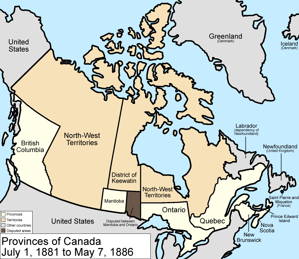
Map of the provinces and territories of Canada as they were between 1881 and 1886. On July 1 1881, Manitoba greatly expanded, using land from the North-West Territories and the District of Keewatin, but a large portion becomes disputed with Ontario. In 1886, the southwestern borders of the District of Keewatin were altered a little, giving a little land to the North-West Territories.
Made by User:Golbez.
[edit] Licensing
|

Dateiversionen
Klicke auf einen Zeitpunkt, um diese Version zu laden.
| Version vom | Maße | Benutzer | Kommentar | |
|---|---|---|---|---|
| aktuell | 11:59, 7. Aug. 2006 | 1.000×864 (47 KB) | Golbez | (with legend) |
| 04:24, 18. Feb. 2006 | 1.000×864 (45 KB) | Golbez | (Better version) | |
| 01:46, 14. Feb. 2006 | 1.000×864 (42 KB) | Golbez | (better colors) | |
| 12:52, 13. Feb. 2006 | 1.000×864 (42 KB) | Golbez | (date) | |
| 12:02, 13. Feb. 2006 | 1.000×864 (41 KB) | Golbez | (Map of the provinces and territories of Canada as they were between 1881 and 1886. In 1881, Manitoba greatly expanded, using land from the North-West Territories and the District of Keewatin. In 1886, the southwestern borders of the District of Keewatin w) |
Verwendung
Die folgende Seite verwendet diese Datei:

